|
May 17 - June 3, 2002 Dog-Gone-Wild-Cat-Ride |
(If you like, you can skip down through the prose and go straight to the pictures below!)
The log of Jay & Hasty Evans' catamaran "Salty Dog" on their maiden voyage as new owners from Ft. Lauderdale, Florida to Scraggy Neck, Massachusetts at the southern end of the Cape Cod canal between May 17 and June 2, 2002. Crew included Mel Converse, Rick & Sandy Van Mell, Bob & Chris Lancaster and George Trim who replaced Bob & Chris at Norfolk.
Friday, 17 May 2002
Hasty Evans had driven a hundred miles before the whole crew was collected from the Fort Lauderdale airport and, along with piles of sailing gear, safely mustered aboard Salty Dog. Jay & Hasty themselves had wondered if their airplane would even get off the ground given the duffels loaded with tools, parts, safety gear and medicine chest plus all their clothes, wet gear and sea boots. The rest of the crew had their share of gear too, plus Rick's guitar for the anticipated idyllic, harmonious, evening songfests.
Hunger finally interrupted the endless stowing of gear and discovery of ship's systems, driving the crew to the Hometown Buffet in a strip mall less than twenty minutes before its ten p.m. closing. The fare, if not gourmet, was plentiful and varied, even down to Mel's chocolate pudding topped with chocolate syrup and chips, and Rick & Jay's apple crisp buried under frozen yogurt, chocolate sprinkles and drops of syrup. A well-fed, no, thoroughly stuffed crew returned to the boat. Yet there was one more thing to do before crawling into their bunks. Jay broke out two bottles of champagne and in the glow of all of Salty Dog's lights she was appropriately christened with a glass poured simultaneously over each bow by Jay & Hasty while the crew cheered and cameras clicked. Leaving nothing to chance, and respectful of all eventualities, Salty Dog's dinghy was christened "Sherpa", a fitting metaphor made even more so as it was the name of Jay & Hasty's first dog.
Saturday, 18 May 2002
The discovery process continued under sultry, sweaty, clothes-soaking humidity and an endless procession of black clouds punctuated with lightning and vacillating periods of downpour and just plain enervating damp. The two major lists for the day were West Marine and food. First stop was the mariner's favorite toy store where the crew split up to tackle the list. Jay found an EPIRB (by far the most expensive item on the list) and a battery to add to the house bank. Other items included a propane barbecue grill for the stern rail, additional type IV cushions, current flare kit, sail repair kit, engine oil, holding tank deodorant, two 60 quart Igloo coolers, and enough other goodies to run the bill up over $1,200.
Exhausted by such effort, the crew returned to the marina where the staff had laid out a lunch barbecue of burgers and beverages for marina residents. We dodged heavy showers just going the 50 yards between the boat and marina office, then again ate our fill while dripping sweat in the sauna-like muggy heat. Jay, Bob and Mel worked with the marina staff to rewire the new solar panels so they would charge the house bank instead of the single engine battery, then motored a half mile down the waterway to fill the fuel tanks. Rick, Sandy, Hasty & Chris headed off to forage for food, filling three shopping carts and running up a $500 bill - the checker's barcode reader was smoking! With a bit of luck, the gatherers returned to the dock as the hunters returned from refueling, and the provisions were shuttled aboard between rain showers without incident.
Rick's aunt Esther, cousin Vicki and her son Nicholas stopped by for a quick visit between 1630 and 1730. Then the refilled propane tank arrived, the last of the food was stowed and we settled down for a short break for a cold one and a chat with Tucker, the sailor/salesman who had sold Jay & Hasty the boat. He fielded an endless stream of questions about how the boat operated and its quirks as we all tried to absorb the answers. Dinner was gazpacho, chilled by chunks of ice, a welcome refresher from the still melting heat. We slid into our bunks, turning on the little fans and setting the hatches low to compromise between getting much needed air and bunk-soaking showers from passing squalls.
Sunday, 19 May 2002
0643 the engines came to life, and with little fanfare Salty Dog slipped into the Intracoastal Waterway, turned north and hailed the first bridge headed for the Port Everglades sea buoy. As we approached the deepwater channel and the various cruise ships tied along the docks, we were escorted by a series of Coast Guard and police boats which were maintaining security zones around them and the large tankers discharging crude oil. They were taking no chances anyone would try to hijack or sabotage them! We headed east down the channel into open water with ten knots of southwest wind, setting the jib first as we cleared inbound traffic. Salty Dog shook loose like the freed cat she now was and stretched away to the northeast, headed for the Gulf Stream. Slowly boat speed increased to eight knots. The main was hoisted with a reef tucked in since the black clouds and weather forecast portended an approaching cold front - just what we didn't need of course, but the Dog was happy to scamper like a cat, hitting 12 knots over the bottom heading north in the dazzling blue of the stream.
For a time the wind held steady, so we shook out the reef and enjoyed a glorious sail. Hasty stretched her legs forward through the bow pulpit, hair blowing, and a smile from ear to ear. Jay & Sandy sat along the cabin top remarking on the tall wall of buildings along West Palm Beach, now ten miles west along the horizon. The radio crackled with Coast Guard calls for vessels in distress scattered from the edge of the Bahamas bank, 40 miles east of us, and back down the coast to Fort Lauderdale and the Port Everglades inlet. Rick didn't like the look of the darkening sky dead up wind, and the crew had the main dropped, and the jib furled as the front closed in with driving rain and wind shifting into the northwest.
Wind against the Gulf Stream is the perfect formula for square waves, and even the modest 15 to 20 knots quickly built up a chop that slapped at Salty Dog's underside. Sandy tried to relax in her bunk, but was lifted and bounced like a trampoline as we labored through the seas. But the Dog was an agile cat and took the wild ride in stride, and settled down to an easy motion as we left the Stream and closed with the shore and the St. Lucie Inlet. Mel and Bob were spotters as Jay steered through the inlet, while Rick tracked the channel marks with the GPS and computer from the nav station. An osprey cruised by alongside to port with a fish in its talons, a great heron looped an easy pass across our bow, and a manatee boiled the surface to starboard. In the remaining light rain, we tied up at Pirates Cove Marina in the Manatee Pocket at 1713.
We topped off the two fuel tanks, which only took a total of 14 gallons, and calculated the burn rate for each engine - about 1.0 gallon per hour on the starboard engine, and .84 gph on port. The cockpit was hosed down, Hasty & Chris grabbed showers, and all seven of us were picked up by Skipper & Mary Kay Van Mell for cocktails at their home in Stuart. Sea stories flowed faster than the libations and nibbles - a welcome change from the bouncing and damp of the afternoon. Since it seems this crew is rarely fully fed and sated, we again broke into work groups, with the Skipper taking Rick, Hasty & Chris for one more round of shopping, then meeting up with Mary Kay, Sandy, Mel, Jay & Bob at Bare Bones for some great burgers. It was after ten when the crew was safely returned to Salty Dog, and we slept soundly in the lower temperatures and humidity behind the front.
Like any good cruise, there was a Plan. It was like similar plans on Dartmouth cruises - on Mel's Whim, and Steve Blecher's Javelin - so why shouldn't we expect it would work as well for Jay and Hasty's Salty Dog. It was a plan in three parts: Plan A, Plan B (doesn't everyone have a "Plan B", and Plan C - just to cover a wider range. We even included that the Plan could be changed by the whim of the crew. The boldest, Plan C, headed straight north across 353 nautical miles of open ocean from St. Lucie into Charleston, South Carolina. In plan we would cover the distance in about 50 hours and arrive early Wednesday morning.
But there is one other saying we have used over the last several years - there was the Plan, and then the wind hit the Plan. This time Mother Nature reminded us that even a cat as frisky as Salty Dog was subject to the axiom about the best laid plans of mice and men. This was Florida, temperatures were already well into the upper 80's and 90's, the prevailing winds are southeast - perfect for a run north. That is until the front came through with north and northeast winds of 20 knots with gusts to 25. Who would have even considered a forecast of north to northeast winds of 20 to 25 knots from Monday through Saturday - but that's what the weather service dished out for us. We remembered well the square waves of Sunday. So the plan changed.
Monday, 20 May 2002
The good news - the Intracoastal Waterway runs from Florida north to New Jersey, and it's less than a mile from our dock in the Manatee Pocket. The bad news - you can only safely run in daylight, and, as we soon learned, under these conditions a two-knot southbound current sets up in the ICW. Yet it was a joyful crew that shoved off at 0707 with a target of Port Canaveral, about 90 miles north. It was easy to follow the charts and day marks, and scenic too as we passed groomed homes and endless greenery. The autopilot turned out to be the easiest way to steer. A few pushes of a button swung Salty Dog's bow a few degrees port or starboard to adjust to the modest turns along the mostly straight ICW channels. The wind, however howled as predicted, with apparent wind steadily in the 25-knot range all day. Even with both engines running at 2800 rpm, which would give close to 9 knots in calm water, we were lucky to do a little over 8 because of the windage, and under 8 along the more open stretches where small seas could build up.
Another challenge was our mast height. The controlling height of fixed bridges along the ICW is 65 feet. The top of Salty Dog's mast is 61.9 feet off the water, plus a flexible 4-foot whip antenna for the VHF radio. We approached the first fixed bridge at dead slow and inched up to it. The height gauge read about 65.5 feet - the tip of the antenna just cleared the underside of the bridge. At the next one, it looked like just 64.5 feet of water and we brushed the tip across the bottom of each girder on the bridge. At 1421 the Wabasso bridge caught the antenna tip and bent it at right angles about a foot below the top. Apparently the driving wind, pushing the current and piling up water was raising the whole inland system and reducing our clearances all along the way. Each bridge was a dead slow, breath-holding experience. But, we kept making them one by one.
We projected passing Vero Beach around noon, and Sandy called Jackie Mulanax, the registered nurse the family has hired to look in on their 89 year old parents at the Indian River Estates Medical Center. Jackie was delighted to hear from Sandy, and coordinated a special rendezvous. Picking up Sandy's mom, she drove her to the Lobster Shanty, one of their favorite restaurants which is right on the ICW. (Her dad was unfortunately getting ready for an exam the next day, and required to take medications every fifteen minutes, so he was not allowed out for the trip.) Right on schedule, Jackie wheeled Sandy's mom out onto the pier, and though the channel was about 75 yards offshore, we could see her wave clearly and even got a picture.
Though the wonderful wide cockpit with its canvas bimini top was well sheltered from the wind, sitting at either steering wheel exposed the person at the helm to the full force of the wind. The combined current and windage effects resulted in speeds over the bottom in the range of 6 to 6.5 knots - discouraging when we were going through the water at around 8, and could have been doing even more.
Port Canaveral proved to be a bit too long a stretch for this cat, so we nestled in behind the Melbourne bridge causeway after eleven hours under way and dropped the anchor in the shelter of trees at 1818. We had covered 82.2 miles. Aloft, the top of the mast was still in 19 knots of wind, but on deck it was delightful. We broke out some cheese & crackers and the rest of Mary Kay Van Mell's fabulous artichoke/mushroom dip, a beverage or two, then feasted on steaks perfectly cooked on the new grill by Bob, mashed potatoes and asparagus. Hasty presented the crew with their official Salty Dog crew shirts - donned immediately at the table - then Rick pulled out the guitar and we sang "until the green woods rang", and slept a sound, cool and delightful sleep.
Tuesday, 21 May 2002
Somewhere in the early morning Sandy nudged Rick to close the hatch against the incoming rain, and Rick did likewise for the main cabin hatches left slightly open to scoop in the delightfully cool air. Under way at 0700 with only a bit of mud on the anchor, but low clouds and the continuing north wind at 20 - 25 knots apparent as we continued north in the protected waters of the ICW. We celebrated passing the Kennedy space center and it's giant assembly building at 1200 with Sandy's spicy chicken-rice-V8-tobasco soup.
A dredge was hard at work just before the Haulover Canal, and backed out of the channel to let us pass. Good thing too, since the chart showed only 1-2 feet of water on either side. Sandbars were clearly visible a stone's throw on either side. The canal connects Mosquito Lagoon and the Indian River sections of the ICW - and the adverse current poured through it at 4.1 knots. We crawled through and pushed on north up the Lagoon into New Smyrna Beach just below the Ponce de Leon inlet. Jay, Mel, Bob & Rick tuned in the marine weather to see if the wind gods were still angry. Whatever we had done, it was certainly offending because it was getting worse, not better. Simply put: Wednesday, winds northeast 25 to 30 with gusts to gale force, seas to 13 feet. Further, it was predicted to stay northeast through Saturday at the 20-knot level. So much for the idea of heading out the inlet and making a beeline for Charleston, now 234 miles away. The decision is to keep on going up the ICW, running 12-hour days from 7 to 7.
Alternative crew plans are already being discussed! Who can stay longer, where does who get off? Stay tuned for further developments.
As we entered New Smyrna the crew spotted a giant catamaran, spar likely around 80 feet off the water, tied to a nice dock incongruously projecting from a large, slightly rusted, corrugated roofed shed with faded yellow letters spelling out: "SEAFOOD / CAUGHT DAILY". Jay said, "Let's get some fish," and all hands grabbed dock lines and fenders while Jay made a circle and tucked Salty Dog's 42' neatly between two powerboats, against a two knot current, with about 6 feet to spare. Ashore, we were directed into the shed which qualified as a genuine fish house - wood fish boxes, iced fish in a simple, old display case, and just the right aroma of fish, fresh but not ripe. A whole large red snapper and an even larger grouper peered out from under a pile of ice. At the proprietor's suggestion we selected a large, beautiful 4.4-pound filet of grouper, two dozen fresh shrimp which he boiled on the spot, and tropical salsa.
We asked about the local conditions along the waterway, and were directed to King George, sitting in a plastic chair at the rough wooden bench sipping a Coors Light. George was the reason there was grouper to buy. He's been fishing these waters since he was five years old in 1953 baiting hooks for his father's fishing customers. His thin frame, skin tanned to cordovan leather, and deep set eyes attested to his years on the water. He lamented being in the chair instead of out at sea, but there was no way in this weather he remarked. He expected it to get worse, but said it was quite unusual for this time of year.
Back aboard, we hailed New Symrna's bridge and powered through the opening while dinner patrons at the shoreside restaurant enjoyed the view of our passage. Ahead the dark silhouette of the Ponce de Leon inlet light rose starkly 159' from the low sand beach.
We turned slightly west following the ICW channel, then nosed into Rockhouse Creek with the bow less than ten feet from the shore, but still in 10 feet of water. We lay easily at anchor even with the wind around 20 knots at the masthead above the low dune in front of us, slightly swung by the ebb tide out the inlet. To the east we could see the breakers rolling in from the open Atlantic and sweeping over the breakwater on the north side of the inlet, occasionally exploding in towering clouds of white spray.
As soon as we were squared away, Hasty spread out two pounds of fresh shrimp and sauce on the cockpit table, washed down with some Sauvignon Blanc. Bob did the grill honors again, only slightly delayed when the wind blew out the burner for a while, while Rick chopped up a salad. Grouper dinner was served in the main cabin as our first meal inside around the table. Outside the wind whistled through the rigging, but we all turned in early and slept well in the cool air.
Wednesday, 22 May 2002
At daybreak we didn't need to check the weather forecast to confirm the increase in wind. Our cat shook in the strongest gusts; the white water over the breakwater was now so high and continuous that the breakwater could not even be seen. The forecast had been upgraded to gale warnings for Wednesday and Thursday - clearly there was no chance of going outside for several days - but the sky was mostly clear at sunrise. Rick & Mel blinked over their morning coffee, then grabbed the binoculars to confirm that a sailboat, with only a reefed main set, was coming through the inlet. By the time we had cleared away the anchor and gotten under way, she had rounded into the ICW channel and was alongside. We hailed to find out where they had come from. Their response was, "Charleston, and, by the way, did we have any bleach aboard so they could clean their underwear!"
We turned up the engines to our 2800 rpm cruising speed, making a little over 8 knots through the water and around 7 over the bottom. The first challenge was to time our arrival at the Daytona Beach bridge that was closed between 0745 and 0845 for morning rush hour. We adjusted speed and arrived with a few minutes to spare and were the only boat let through at exactly 0845 while several boats farther astern had to wait for another cycle. With the wind, even in these sheltered waters, gusting over 20 knots maintaining a holding position for bridges at very slow speeds was tricky. As we worked our way under the fixed bridges, Jay delicately inched Salty Dog under each one; this morning we brushed the broken antenna against two and cleared two.
Bob was stretching in the cockpit and doing his morning exercises, which prompted Jay to suggest we all do tai chi to stay in shape. This prompted a follow up discussion of how Bob had applied to be on the Survivor program, getting as far as an interview in the Boston TV station. Noting the coconuts we had on board, he remarked that his fermented coconut wine would probably keep him on The Island at least for a little while. Bob settled down with a nice green coconut in hand and carefully created "Wilson", eyes and mouth carved out, with nose projecting. Wilson became our mascot and good omen, even to naming the autopilot after him.
It's 1045 and the weather radio drones: "wind increasing this afternoon to sustained winds of 30 knots, gusts to 40." The wind gods have obviously little regard for our Plans! Salty Dog didn't mind in the narrow, sheltered channels of the ICW and purred like a good cat as we motored along. Amusement amounted to watching a manatee swim around near milepost 815 and the topless crew on a southbound sailboat at the same time.
The long stretch of low, dense palms and undergrowth was broken around mile 802 on the port side by the new development of Palm Coast. The chart showed a labyrinth of canals stretching two miles along the canal and a mile west. The fresh cuts and clearing were making way for large, elaborate houses, a golf course, and many with screen-enclosed swimming pools - all in what you would describe as the middle of nowhere. At one entrance off the ICW a new tidy marina advertised fuel - at $1.75 a gallon for diesel (compared to the $1.13 we would enjoy shortly in St. Augustine.)
Around milepost 795 we caught a glimpse of the ocean with a solid mantle of white foam - at the same time it was blowing 30 knots and we were pushing our own waves on the ICW - reinforcing, if we needed it, the wisdom of our decision to stay inside.
We arrived at St. Augustine's Lions Bridge at 1615, just 15 minutes before it's last opening before a one hour closing for rush hour. We cleared it shortly after 1630, and braced ourselves for crossing the St. Augustine inlet. The familiar massive, thundering, rolling white breakers smothered the north side of the entrance. A strong, swirling 4-knot current was flowing in the channel driven by the wind and tide, and we had to go east to buoy R60, the inner end of the channel, to make the turn to port back into the ICW. An equally strong counter current flowed eastward out of the channel we were turning to enter. Buffeted by 25-knot winds, we made the turn, proceeded under the fixed bridge, and turned into the Camachee Cove marina.
Our plan, though it was already 1700, was to fuel and water, then push on for more miles. The tranquility of the marina, the howling wind, and the blackening sky tempted Jay into deciding to stay at the marina for the night. The crew cheered and toasted him for such kindness and generosity. While some of the crew cleaned ship, others did a West Marine run and reprovisioned. Mel & Rick were able to make internet connections to check email, though Rick's upload program crumped out and he put out an email call for a rescue.
With so much fresh water at our disposal, the crew decided to shower and clean all the dirty duds. A large and hearty Chef's Salad with the last of Monday's steak dinner was washed down with a bit of merlot, while the clothes were drying. The wind whistled and howled and shook the boat, even tied to the dock in the shelter of the marina. We tried to turn in early but the laundromat kept Hasty & Chris working the dryer 'til the damp clothes were passably dry. Rick's new Salty Dog shirt was almost a causality when it blew off the bimini. The crew slept soundly after a windy day.
Thursday, 23 May 2002
Rick was up early and went ashore to see if a savior email had arrived overnight. Thanks to fellow Islander 36 owner Gary Salvo back on San Francisco Bay, there was a copy of the FTP program attached to an email, so the web page and pictures could be uploaded and made available to our family and friends. Since it takes quite a while to upload the pictures, we only got the log page and a fraction of the pictures uploaded before the crew was anxious to shove at 0700.
A soft, quiet morning suggested the worst might be over - even though the forecast didn't yet agree. It called for winds shifting NE in the 20-knot range, then going easterly on Friday, followed by a shift back to the north and increasing again for Saturday and Sunday. Ironically, the easterly shift would have been terrific back at St. Lucie when the course to Charleston was due north. But as we moved north up the ICW, we also were taken west - 60 miles west of the straight line from St. Lucie to Charleston - and we have to make up those 60 miles before we get there!
It was so nice when we cast off from Camachee Cove; we set the jib and steamed along at 9 knots - for all of about 25 minutes. Then the wind shifted back north, on the nose, and we furled the jib. Gray stratus slid in from the ocean bringing misting showers. Yet the winds were down under 20 knots most of the time, and occasionally we even had the current with us.
That was not so good as we approached fixed bridges with an unforgiving push into the immovable object. Jay would actually have Salty Dog going slightly in reverse to gingerly let the antenna tell us how bad it was going to be. As we approached one bridge, the gauge read an extra foot more than any we had seen in the last day, yet it hit the antenna lower than any other and just barely cleared the anemometer and windex. The crew had a treat when three wild ponies decided to graze near the shore as we passed close on the shore of Cumberland Island.
The big event of the day was crossing the St. Mary River from Florida into Georgia. One state closer to home! We worked our time-distance spreadsheet to estimate our arrival times at various points, and the afternoon conversations debated how far to go. The 5-mile jump across open water between Cumberland and Jekyll Islands will test how the seas are behaving. It's "only" a 135-mile direct line to Charleston, but the course would be NE, directly into the predicted wind. Following the ICW around the curve of South Carolina, and all its twists and turns, is 220 miles to Charleston. Slow and comfortable or ????? Probably a decision to be made with the last weather reports tonight and the first ones tomorrow. It's 1630, ten miles to go to mile 690 and a taste of open water.
At 1700, 2.5 miles below the St. Andrews Sound opening we began feeling the swells sweeping around the point. The ride across, out to buoy R32 and back was bouncy, with plenty of white water exploding over the shallows outside the channel. Sandy was on the helm and kept her right on course.
We turned in behind Jekyll Island, motored past the marina, gave everyone quite a sight tip toeing under the fixed bridge, and continued on toward St. Simons Island, the inlet for Brusnwick, Georgia. By this crossing the seas had diminished noticeably and the wind was dropping too.
A large car carrier crossed our bow as we entered the deep-water channel, and the clouds began to clear. We dropped our anchor at 1930, about 45 minutes before sunset, just off the Lanier Island marina. Once again Bob was called to the grill, chicken breasts this time, accompanied from the galley by mashed potatoes and carrots. We discussed the options, and decided to try an open water run for Charleston starting at 0600 on Friday morning. It was a 131-mile run, and with some luck we could do it in 18 hours or less, arriving around midnight. Rick, Mel and Bob picked waypoint and set up the GPS for the morning departure. We all turned in before 2200.
Friday, 24 May 2002
A light ripple flecked the still water as the engine came to life before the sun rose. Under way at 0605, the ride was smooth around St. Simon's point and only moderate bouncing as we started out the channel amid a fleet of a dozen fishing boats. The sky was clear and the wind light but west of north. At buoy 6 we turned northeast for Charleston.
Finally Salty Dog was free of the narrow channels and fixed bridges. The wind wasn't much, but we set both main and part of the jib which added only a tenth or two to the speed, but helped steady the boat in the remaining swells.
By noon it had gone flat, and filled in from the southeast by 1400 giving us a good push as the Dog scampered like a cat at over ten knots through the water (we do, however, think the speedo reads a little high), and a more modest but enjoyable 7.5 to 8 over the bottom against the adverse current.
With a projected ETA between 2300 and midnight, a bright day and favorable fresh breeze, we started considering alternatives. Stop, or keep on going past Charleston to: 1) Georgetown; 2) Cape Fear (Wilmington); or even all the way to Morehead City/Beaufort. Each port had its issues. Charleston had only about 4 miles to run into the channel and another 2 or 3 to a marina, but we would be arriving in the middle of the night. We'd reach Georgetown early in the morning, but it was 15 miles up the river to the city, and 15 miles back out - or ten miles longer, plus bridges back into the ICW. Cape Fear had a nice marina just 6 miles in, but you had to come out 12 miles to turn north for the continuation to Beaufort. When we checked the engine hours and fuel consumption, we determined that Cape Fear was at the outer range of our fuel. After several iterations of alternatives, we determined to put into Charleston, refuel when we could, and then head straight for Beaufort as early as possible Saturday morning.
As we reviewed the various marina possibilities, we found the marina at Patriot's Point (remember Fort Sumpter is in Charleston) advertising "24 service". Mel's cell phone was able to pick up a signal, even though we were 18 miles offshore and still 42 miles from Charleston, and connect to verify that they would indeed fuel us at any time - we said to look for us around midnight. They said, "Call us on channel 16 when you arrive."
That settled, it was time to enjoy this beautiful day. Bob spotted an indigo flying fish, skimming over the wave tops for up to 100 yards. Jay jumped up to point to an 8-10 foot hammerhead shark right alongside who was as surprised to see us as we were him! We finished dinner just at sunset, furled the jib and main as the wind had gone almost dead aft, and passed two more fishing boats rolling south, homeward bound with their nets hanging from their booms.
The forecast is still good for Saturday, light SE, and similar on Sunday, but another ominous forecast looms for Monday into Tuesday for the offshore waters around Cape Hatteras. Not gale, but storm-force winds, 30-40 knots with gusts to 50 and seas to 17 feet are not encouraging. But we'll worry about that tomorrow.
On one hand, experienced voyagers of the sea, and circumnavigators in particular, routinely delay their arrival at an unknown port until daylight, preferably with the sun behind them. Our ETA at the midpoint of the Charleston channel was about 2330. So we approached a major port with at least 4 miles of narrow channel bordered by shoals as shallow as 3 feet, too shallow even for Salty Dog, and the prospect of commercial traffic outbound.
Before a gentle reader rushes to any conclusions that we were a bit casual about such an arrival, take a minute to reflect on the crew. Of the seven of us, six have been sailing since age 10 or earlier, and all were at least 50 - over 270 years of combined experience without revealing any more specific ages.
Yet even so, rolling across the remaining 2' swells with a 2.3 knot ebb to fight going in, spotting the channel marks against all of lights of Charleston had the adrenaline level fully awake. The channel buoys blinked their reds and greens only once every 2.5 to 4 seconds - like trying to find a red tulip occasionally visible amid a field of thousands of sodium-yellow ones. A shadow passed slowly across some of the lights three miles away. Mel got on the radio and raised the skipper of the outbound freighter and agreed on a two-whistle (starboard to starboard) pass, and learned that a second ship, actually closer to us, was going down the channel. The first vessel momentarily blanked out the range lights, then passed like a silent hulk close alongside in the moonlight. The second ship was a large container ship, and passed just as we abeam of the buoys between the unlit ends of the jetty.
Thanks to the elegant precision of GPS navigation connected to a computer, we could watch our position exactly move up each section of the channel. Guided on deck by the range lights, the GPS and computer quickly alerted us if we moved from the center of the channel. That came in handy as yet another outbound container ship asked us to stand by the edge of the channel at the last mark before the marina. We tied up at the marina's fuel dock, 8.8 miles in from where we had intercepted the main channel, at 0113 on May 25th. We topped off the fuel and water tanks, passed the garbage ashore, moved the boat to an empty space on the outer marina wall and fell asleep.
Saturday, 25 May 2002
Three and a half hours later we were up again to shove off for Beaufort, North Carolina - 203 miles, and about 27 hours away. It was not our usual quiet, solitary slipping out of port. Today was the great Charleston Marlin Tournament - so we were surrounded by fishing boats (the private kind, not the commercial kind) buzzing past us. We took a better look at Fort Sumpter as we headed out.
We set the route and the autopilot just outside the ends of the jetty, and would not have to touch the helm for 24 hours if we so chose. What little wind there was, was from dead astern, so we simply powered along at about 8 knots under a bright and cloudless sky.
By noon the wind had increased a little and swung SE, so we rolled out the jib and picked up a tenth of a knot or two. That may not seem like much, but over 24 hours it can take an hour off the total time. By late afternoon we set the main too and continued on our way.
Twice a pair of dolphins came alongside and danced in our bow wave and played around the boat. Flying fish abounded, and the yellow seaweed of the open sea was frequently seen. The water was a deep, welcoming blue, and at one point Hasty even sat down on the bottom step of the port pontoon and dragged her feet. Of course we all suggested she was trolling for dinner, etc.
A simple lasagna dinner was followed by an impromptu, acapella songfest in the moonlight in the cockpit as we spotted the lights of Frying Pan Shoals and a large freighter headed south farther out to sea. The silvery glistening water under the full moon, the soft air and gentle motion were exactly what we had come for. Even the forecast was no longer so ominous - nothing more than 35 knots, and that only out in the Gulf Stream next Tuesday. Tomorrow morning should see our arrival in Beaufort - 0742 at the channel light if the electronics have their way - and we will then decide the big question: inside or outside around the mighty Cape Hatteras.
Sunday, 26 May 2002
FUGAWI tracked us right down the blue route line and we arrived at the Beaufort sea buoy at 0825. Salty Dog is equipped with a full compliment for Autohelm instruments, including speed, depth, wind, electronic compass, autopilot and system integrator. We have been perfecting our knowledge and fine turning their parameters as we went along, but they have worked well. The first major adjustment was getting the magnetic variation set correctly, and for a day, we were maddeningly prevented from getting it off the 13 degrees west it was set on to the 5 degrees required along the Florida coast. The system is just old enough that it does not automatically pick up variation from the GPS the way all current GPS systems do. The reset secret turned out that we needed to use the autopilot control rather than the GPS unit to do it! The other glitch that still persists is that the boat speed seems to read at least a full knot too high - great for moral, but resulting in the system claiming we were always in an adverse tide of about 2 knots. This adjustment may require us to take an hour or so and sail a measured course to get an accurate reading - and we're more interested in making miles north than caring about the accuracy.
One reason we weren't concerned is that we had a completely separate system tracking our progress. Rick's GPS connected to his laptop computer running FUGAWI shows a boat icon located by GPS position on a chart on the screen. Adding the features of waypoints and routes, this system shows at a glance both where we are and where we are going. By setting the same waypoints into the ship's Autohelm system the two systems tracked the boat completely independently and were a constant check on each other. They have remained exactly in sync so far. If this belt-and-suspenders was not sufficient, Bob had his handheld GPS aboard, and we regularly noted our position in the ship's log and moved a "sticky" on the paper chart at we passed various waypoints.
It was this system that brought us right up the channel to the Beaufort city front docks on Sunday morning. For those of us (arrogantly?) used to the 24/7 services and convenience of big-city life, learning that Beaufort, North Carolina basically didn't open until noon on Sunday mornings was a momentary setback. Yet, the dockmaster was able to fill our fuel tanks, and find us a hose to fill the water tanks. Shopping? Laundry? "Sorry," said the dockmaster, "doesn't open until after noon." Hasty, our consummate politician, picks up our story as follows:
"I met Bill and Bernie, and their friend Jack, standing by the harbormaster's office. Bernie had all of her laundry and soap resting on the table beside her. So of course I went up and introduced myself, and asked her where she was going to get the laundry done. Bill said they were trying to go across the street, but since that laundromat didn't open until noon, they had acquired a courtesy car from the dockmaster, and had directions to a laundromat that was open some 4-5 miles away."
"I asked if they might have room for me with some laundry, and they said they thought there would be. Jack indicated they were getting a station wagon, so I said, Gee, could I bring another person along since we had some grocery shopping to do. Jack said, sure, and when the car arrived, I said, Gosh, could we squeeze in a third person who could sit in the back? We duly arrived at the laundromat in the IGA shopping plaza, and Sandy, Chris and I loaded the washing machines. I asked Jack if he could wait ten minutes while Chris & I did the grocery shopping before he took the car back, and return later to get the finished laundry and Sandy."
"While shopping (in those "ten minutes"), I discovered that the local blue laws prevented us from replenishing the beer & wine supply until (guess when) after noon! So, I asked Jack if he could wait until just after noon to return the car. This worked out well because our laundry was not yet dry and they had shopping to do too. While Bill & Bernie shopped, Jack took Chris and the food we had purchased back to the dock, then returned to the IGA/laundromat to pick up Bill, Bernie, Sandy (our laundry & booze) and me. Amazing what friends you can find along the dock. It must have worked out well enough because they waved a friendly good-by and wished us a good trip."
Decisions, Decisions! Inside or outside around Cape Hatteras? The weather forecast was generally SE 10-15 for at least 36 hours along the shore, but SE going E in 24 hours up to 25 or 30 knots farther offshore. The weather was acceptable, maybe even "thrilling" with the prospect of good speeds, but building seas the farther along we went. We sought out local knowledge. The dockmaster, when innocently asked which way to go by Mel, said simply, "inside". No reason given. Jay had spotted another large catamaran on the next dock and introduced himself to Nick Sear, the owner of the Catana 48. Nick told tales of taking 30 hours to get back to Beaufort from Ocracoke Inlet, about 45 miles or half way east to Cape Hatteras. Nick had never been around the Cape in the year he has owned his boat. The dockmaster gave Jay a phone number for the National Weather Service office nearby. The meteorologist confirmed that the weather was going to be OK, and that the low pressure system coming up from Florida which was to produce the heavier winds was still just a figment of the computer models. He estimated, however, that leaving at noon today, Sunday, we wouldn't get into Norfolk until Tuesday afternoon vs the Monday evening we were calculating - but never did get to why the estimate was so different from ours. Inside, was the decision, so away we went into the ICW, held up only about ten minutes for the 1300 opening of the Sawyer Bridge.
The day continued beautiful, the greenery and houses clearly different from the ICW in Florida and points south. Gone were the big mansions, replaced by either very modest and simple older buildings or new buildings on pilings at least 6 to 8 feet above ground level - assumed to be hurricane waters protection. Another difference was the families wading or casually fishing along the banks, pickup trucks parked not far away. Bob remarked at the proliferation of boat-lifts at the docks and how they were an environmental issue on Cape Cod where they were considered "visual pollution" and permits for them were often denied.
Twenty miles up, the ICW enters the Neuse River - an extension of the western end of Pamlico Sound. Pamlico is formed by the boundary beaches to the south and east which define Cape Hatteras. Pamlico, though generally less than 15 feet deep in most places, stretches out 25 to 50 miles wide and over 30 miles north and south with many islands and shoals down to 1-3 feet. The ICW winds through its western edge through river fingers and dug canals. In the open spaces, as we came to later in the afternoon, it resembles a very large lake with no land visible on the eastern horizon. We set main and jib and enjoyed a delightful sail. Since we would not be able to run all night as we would have if we had gone outside, we wanted to make as many miles as possible.
We selected a target cove about 60 miles above Beaufort, and arrived about 25 minutes after sunset in the growing dusk. One other boat had already anchored in the entrance to Slater Creek along the Pungo River section of the Sound, but there was ample room for us too. Mel meticulously read FUGAWI to give Hasty inch-by-inch headings and distances until the anchor finally dropped exactly on the 9 foot mark on the chart.
Serenity can be defined as this spot. Sheltered by the unbroken stands of lodgepole pine, the wind was just enough to minimize bugs as we set the cockpit table, Bob once again grilled chicken, and we settled down to brown rice and asparagus, washed down with chilled white wine. An orange-red full moon poked above the treetops, seemingly pushing aside wisps of cloud, to brighten into shining splendor. Another round of guitar playing and singing echoed out across the water - no muskets shots were heard, so we assume we didn't offend too many natives.
Monday, 27 May 2002 - Memorial Day
With many miles to go before we sleep, Salty Dog's engines purred to life at 0540. A picture-demanding sunrise of yellow, red, purple, and shades of gray to black cumulous bits marked our departure from Slade Creek. Eight miles further we entered the Alligator River - Pungo River Canal, ten miles of straight, unchanging trees and stumps punctuated by two fixed bridges that we cleared with a few inches to spare. A few large bumble-bee size horseflys explored the confines of the Dog's big cabin, but departed voluntarily or with swinging persuasion.
It was flat, glassy calm with little apparent current in the broader sections of the Alligator River. We took the 1.5 mile distance between channel marks to recalibrate the speed unit, getting the autohelm speed to match the GPS speed within a tenth of a knot. We also developed a speed curve by idling the engines back to 1500 RPM, noting the speed, then repeating the process at 1770, 2000, 2500, 2700, 2800, 2900, 3000 and 3200 RPM. We even tried running under one engine in case we should ever lose one engine - an obvious difference, particularly at higher RPMs.
After lunch, we tackled the problem of the bridges. In the twenty miles south of Norfolk on the ICW there are 13 bridges, half of them with restricted opening times, including a lock which separates the tidal levels between Chesapeake Bay to the north, and Albemarle and Pamlico Sounds to the south. Rick put together a spreadsheet of the bridges, theirs distances apart and allowed for both north and southbound directions, chosen boat speeds, and adjustments to account for delays when arriving at a bridge that only opens every 30 minutes, or only once an hour. Our target, going north, is to hit the first bridge at 0800 and get through all 13 bridges by 1145 with only 85 minutes of delay time. We'll see how this grand plan works in reality tomorrow.
Just as we were finishing this chore, we arrived at the Midway Marina in Coinjack, NC, around milepost 49 at 1630. Even though we had set this up as our target destination for the day, and as a place for dinner, with another 3 hours of daylight and the bridges to run tomorrow, we pushed on to the Pungo Ferry Marina, just into Virginia.
From what we saw, Pungo Ferry is a two building town: The dock & General Store, and Captain George's Restaurant. We patronized them both, even taking Wilson along to sample the extensive buffet at George's, which brought plenty of comments from nearby tables and our waitress. A number of folks were impressed with our journey, and a few walked down the short beach to the dock to look over this strange boat that just brushed the high bridges.
Tuesday, 28 May, 2002
Mist covered the water and lay across the marshes. We could hardly see both banks as we shoved off at 0611 headed for the last stretch of the ICW. Mel talked Rick around the bends using FUGAWI at the nav station. The rest of the crew marveled at the almost surreal, ghostly images of trees and stumps through the thin fog. Ospreys chirped their warning from each nest atop the channel marks as we passed, many with young mouths to feed.
Ahead were the 12 bridges and one lock we had to deal with. Our prediction program worked well, and after adjusting for getting a half hour earlier start than planned, we hit bridges almost on the minute. By pushing a little, having 4 power boats in front of us, and getting Hasty to be a most persuasive supplicant on the radio to the bridge tender, we saved 30 minutes by just catching the opening of the second bridge. The passage through the locks went smoothly, and the rest was easy. That is if you count dodging incoming barges and ships as we passed the extensive docks and naval piers of Portsmouth and Norfolk, Virginia.
We celebrated Mile 0 of the ICW, noting that we had come 1,092 miles on the ship's log from Fort Lauderdale, then continued on the last 17 miles around the bottom of Chesapeake Bay to Little Creek. Cape Hatteras and the ICW are behind us, now we look forward to a stretch of the North Atlantic on the last legs for Cape Cod.
With the good luck on the bridges, (Ok, skill) we arrived at Little Creek at 1335, stopped for refueling, then tied up at Cobbs Marina. The crew divided into work crews, with
Rick heading for the Internet connection and uploading the web page and almost 100 pictures, (allowing for Mel and Hasty to check emails too), then Jay, Hasty and Sandy went off for boat stuff and food shopping. Bob & Chris washed down the boat and had Salty Dog looking beautiful by the time we all reassembled at 1830.
Jay, having regaled us with tales of his days in the navy stationed around Norfolk, said we had to go to Bubbas for dinner. George Trim, Jay's brother-in-law, arrived (with more food - what else) in his car, having driven from Cape Cod. So we all piled into the mini van and away we went. Bubbas sits along the water, gulls begging food from the pilings a foot or two from the patrons - Bob played French-fry-pitch-and-catch with one particularly adroit gull. Being the sober, somber crew we were, it took only a little persuasion for our server to take our picture to document this momentous event.
0630 was set as the departure time, and we turned in.
Thursday, 30 May 2002
Sadly, we bid adieu to Bob & Chris who helped us cast off, then piled into George's car to drive it back to Cape Cod. With a bit of bravado, we entertained thoughts of sailing straight on to morning (oops, wrong story) - but at least right to Block Island.
It was glassy with some remaining swells from the SE. Under power we made a very little bit over 7 knots - less with tide against us. Putting the old Excel spreadsheet to use once again, it soon became apparent that the 48 hour run would consume around 36 gallons of fuel - leaving perhaps 10 in each tank. With a weather forecast that still talked of a frontal passage (but not the NE winds that all to often come with it), we decided the margin of safety was less than we wanted with so little experience with Salty Dog, and stayed with Plan A - Cape May, New Jersey as our destination.
We rolled along, hazy at times, rocky at times, along the outer beach of Maryland and Delaware, then crossed the mouth of Delaware Bay in the dark and eased into Cape May at 0220 Thursday morning.
Thursday, 30 May 2002
Fog set in just before sunrise and obscured the Texaco sign across the harbor. But Jay pushed us through the shallows, literally, and we fueled and headed out to sea by 0710. We again stretched, agreeing to head for home - Scraggy Neck - and laid out our route of 255 nautical miles. Our course parallels the New Jersey shore very closely for about 5 miles, then separates from the shore until we are almost 50 miles SE of the Verrazano Bridge, and slowly converge with the Long Island shore before slipping east of Block Island into Buzzards Bay, a bit over 220 miles, then slide the last 35 miles to Scraggy Neck. Funny thing is, we don't change course. It's the land that goes away, first north, then gradually east to catch us. The old expression of going "down east" to New England it literally true.
Once again, after a few early morning coffee jitters we think, the autopilot takes over and away we go. In the soft, quiet air the morning fog comes and goes. Sandberg, to paraphrase, described it well:
The fog comes on little cat feet.
It sits looking over harbor and city,
On silent haunches,
And then moves on.
Salty Dog plays cat and mouse with the thin white gauze that thickens and thins with visibility varying between a quarter and half a mile. Jay squeezes off the fog horn at intervals, but there are no responding horns. We carefully make our way on course: 62 degrees magnetic.
Slowly the ripples of new wind cut the remaining 1-3 foot SE undulating swells. With our forward speed, the apparent wind was pulled too far forward to set sail, but by 1530, it had grown and pulled aft enough to set main and jib. Salty Dog responded with an extra half a knot, cutting an initial hour off our projected arrival time.
As the wind built, she settled down into those hours of shear joy on the open ocean. The full circumference of the horizon unblemished by land or ship. Not a cloud to differentiate the quadrants of the sky. Cool yet refreshing the wind blows against the side of your face as you pan your view for ships, or danger, or the sights of the sea. Sandy spots a large sea turtle, up to look around. George sees a pod of dolphins playing. The Dog is free from her leash and bounds gently over the swells, and you feel both free and exhilarated, yet very humble, in the blue expanse of the sea.
George, who has taken over the galley in grand style, serves up pork tenderloin which, if possible, seems to top the chicken curry he served last night, and the Canadian pea soup he ladled out for lunch. If it is true an army fights on its stomach, this ship will conquer all obstacles.
Reality intrudes in the form of ships in and outbound for New York. A medium size ship outbound emerges from the haze and crosses about 3 miles ahead. A large container ship appears seaward, and in 15 minutes passes a few miles astern. Fishing boats dot the horizon, and we are paced, for a time, about 3 miles to seaward by a Coast Guard cutter on picket patrol.
Speed-over-ground, SOG, climbed over 8 knots as the wind increased from the SE, with the apparent wind about 60 degrees off the starboard bow at up to 16 knots. A delightful way to sail into the evening watches. Mel devised a new watch cycle with George replacing Bob & Chris, and setting up single person watches from 0600 to 2100, then two person watches for 2100 - 0000, mid-watch from 0000 - 0300, and morning watch from 0300 - 0600. The night watches were Jay & Hasty, Rick & Sandy, and Mel & George.
Friday, 31 May 2002
Far to the west in the first minutes of Friday the faint yellow/orange glow on the horizon was the loom of New York, with another slightly to the right. We were starting to close now with the Long Island shore, still 25 miles distant, but running a slowly converging course.
Above, in the pure black midnight sky, the familiar summer constellations march along the zodiac. Cygnus, the heart of the Northern Cross with the Milky Way draped across it, Leo, the Big and Little Dippers, and Cassiopeia were friendly companions. A faint loom to the east grew into the 0027 pumpkin orange moonrise. She grew into a silvery beacon filling the cockpit with soft light and illuminated the horizon - all the better to keep a watch.
Sandy spotted an inbound tanker's lights dead ahead on the horizon. She moved safely off to port and vanished. It took two hours to finally drop astern the brightly lighted tug and two barges Mel and George had left us with at the change of the watch. A pair of white lights appeared seaward, about 30 degrees off the bow. Sandy remarked after a minute that she appeared to be on a converging course. As we watched, she drew closer and then slowly the angle changed and it appeared we would cross her bow as her bow and stern lights were directly over each other and she was about two miles away. A few minutes more and the lower, forward light, had clearly moved to the right of the higher stern light, and her green starboard light could be seen, first through the binoculars, then visible with the naked eye. She ghosted across the silvery moonlight path a mile to sea and quickly disappeared astern. Five minutes later her wake rolled toward us like the shockwave of an earthquake, illuminated clearly as it rolled the length of the moonlight until it gently rocked the Salty Dog.
By daybreak the fog had returned. We issued a Security call on channel 13 as we approached the departure buoy for the shipping channels in and out of Block Island Sound, then adjusted our waypoints to hold just SE of the traffic lanes. Our course change put the departure buoy almost exactly on our new course, and as the 5 minute predictor pointer on the computer screen touched the buoy, we all focused eyes forward. Hasty spotted it in the haze about three minutes ahead, and, as if a reward for our vigilance, Sandy reported the fog clearing to windward, and in the two minutes before we reached the buoy, the fog had cleared to bright sunshine. Hasty didn't want to make it a racing-mark passage, and we disengaged Wilson (as we have named the Autopilot in honor of Bob's Wilson) and made a tiny adjustment.
With the wind increasing and shifting west of south, with the forecast holding off the thunderstorms until late afternoon (even though they are now talking potentially severe north and west of New York), Jay called for a course change up Vineyard Sound to catch the tide, enjoy the ride, salute their favorite anchorage at Tarpaulin Cove, turn north through Woods Hole and home to Scraggy. Forty miles to go at noon. Salty Dog is a scampering cat with SOG pushing back up over 8 knots as we get drawn into the tide.
Mel called out, "Land ho!" It was 1259, and Cuttyhunk island's low profile appeared off the leeward bow. Moments later the sand dunes on Marth'a Vineyard rose to starboard as we entered Vineyard Sound. On a glorious quartering reach, the cabin, cockpit and spreader speakers resonated with the sounds of PB&J's version of Four Strong Winds. Priscilla, Bob and John are friends of Jay & Hasty's and recorded this particular tape at their house. Hasty was at the nav station singing along, while Rick did the same in the cockpit sitting at the weather steering station. In the comfort of the passage, with blue skies, sparkling waves and gently rolling swells, it just seemed to fit:
Four strong winds that blow lonely,
Seven seas that run high,
All those things that don't change,
Come what may............
But come-what-may soon brought us to beautiful Tarpaulin Cove, the British naval headquarters during the revolution - particularly with the Loyalist settlement on Martha's Vineyard that, at first, preferred the British side rather than the revolutionaries'. The cove had one remaining house from the 1800s, and a simple lighthouse. This cove and Falmouth Harbor, further up the sound, were famous whaling stops - recall Falmouth For Orders. Tarpaulin's reputation was more bawdy in nature, gently said, an R&R stop for whalers returning to Quaker Nantucket. At first glance these do not look like our expectations of a "harbor", they are more like open roadsteads, but ideally suited for anchoring clumsy square-rigged sailing ships in 25-30 feet of water with easy access and some shelter from the currents of the Sound.
We gybed over, reached up into the Cove, tacked around a rock near the beach, then bore away to the east headed for Woods Hole. Famous in sailing lore for hundreds of years, the Hole is easily the final exam for serious navigators. While benign at slack water, in full flood or ebb, in fog, it has tested the nerves of countless sailors. Today we caught the start of the flood into Buzzards Bay, cut a corner or two and skimmed over some 6 foot depths, and blasted into Buzzards Bay on the increasing SW wind.
Our friend Steve Blecher called on the cell phone from New York to see how we were doing - it was already nasty in the city. Off to the west, along the north shore, a gray mass of sullen cloud seemed to squeeze between water and sky as it steadily approached. We raced past Cleveland Ledge Light, the lower end of the shipping channel leading to the Cape Cod Canal, furled the jib, gybed outside the shallows off Scraggy neck, and reached in.
Jay rounded Salty Dog into the wind directly offshore of their house. The main dropped nicely between the lazy jacks, and, after a futile attempt to pick up the half submerged winter mooring from the tall bows of the cat, backed the stern swim ladder to it. In one simple pass we snagged the underwater chain and walked the mooring forward to the bow. Jay had spliced a brand new bridle which now shackled neatly to the chain and Salty Dog purred at her new home.
Jay's sister Tamsen, George's wife, and Jay & Hasty's daughter, Tamsen, and her friend Eleanor were on the beach to cheer our arrival. Jay dinghied ashore and brought them out for a short tour and welcoming celebration. With the weather closing in from the west, we all went ashore.
Mother Nature, however, reminded us of her power and generosity by arriving in a spectacular sound and light show as we drove home from dinner, and Mel, Rick & Sandy got more than a little wet, despite their wet gear, rowing out to Salty Dog to spend the night. For Rick & Mel, it was the third time Scraggy Neck and Mother Nature had provided this reminder.
Our log recorded 1,533 miles under the keel. We arrived on the original projected date of May 31st, and the memory will be long and fondly remembered by all aboard.
The Dog-Gone-Wild-Cat had a good ride.
Click on images to enlarge, click "Back" to return. Photos by Rick.
E-mail to Rick Van Mell
 Salty Dog ready to go at Ft. Lauderdale.
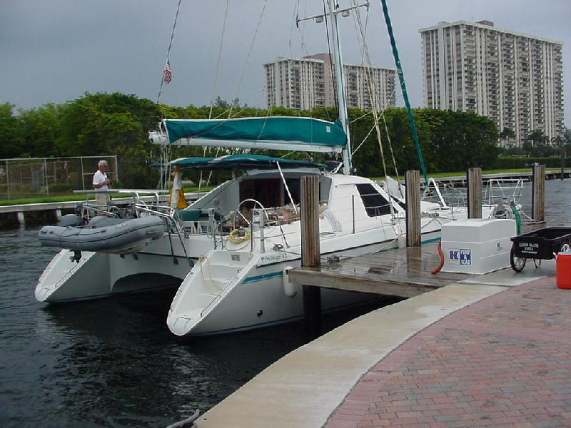 A welcoming cockpit.
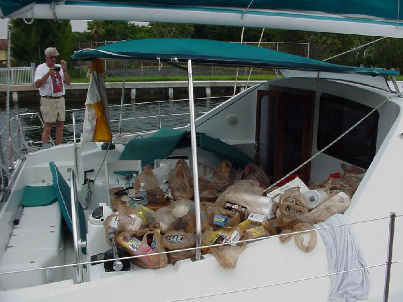 Food, food, food!
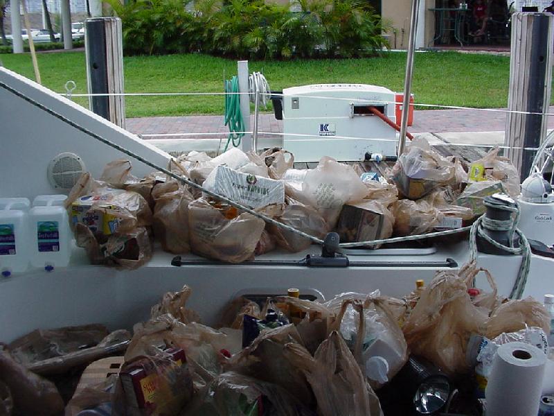 Now what do we do with it?
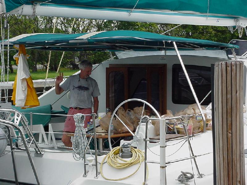 Bob ponders the question.
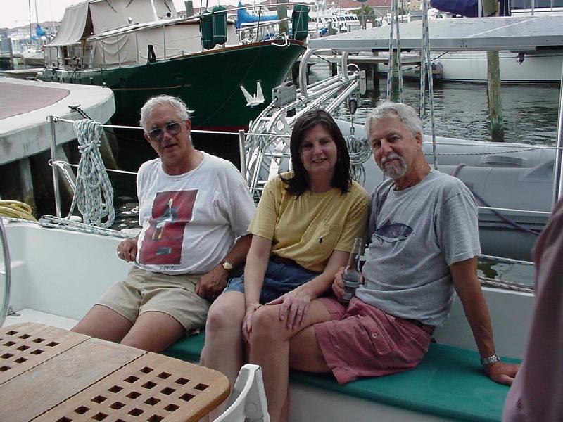 Mel, Chris & Bob take a packing break.
 Refilled LPG tank & new horseshoe come aboard.
 85 year old aunt Esther, cousin Vicki, & nephew Nicholas visit Rick & Sandy
 Hasty repacks the medical supplies.
 Mel on KP duty..
 Ok Jay, cookie or EPIRB?
 Nav station.
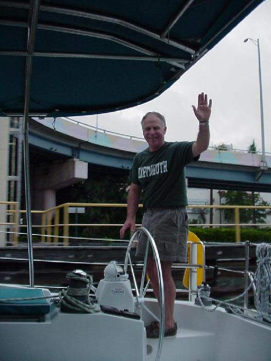 Jay takes Salty Dog under the first bridge.
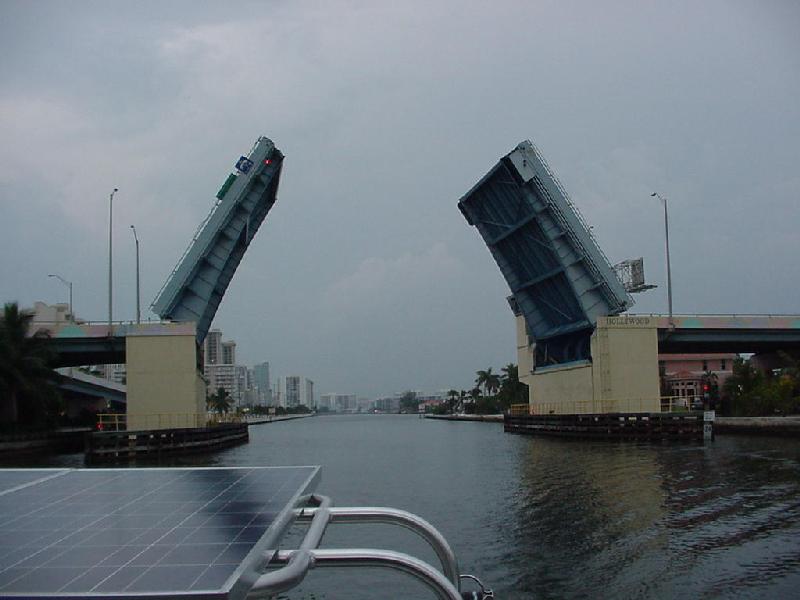 It's safely astern.
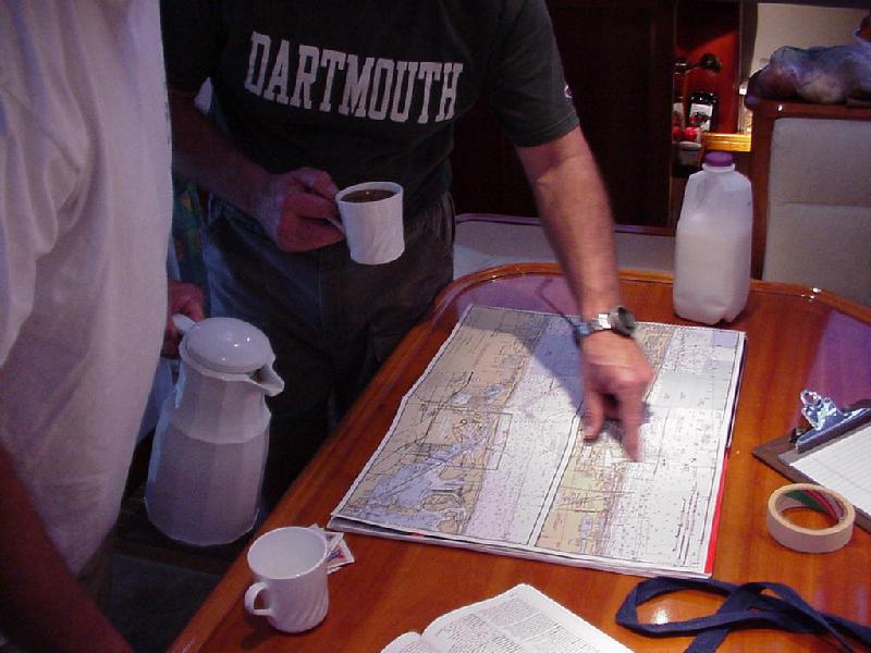 Jay plots a course fortified by Mel's Rocky Coast Roast coffee.
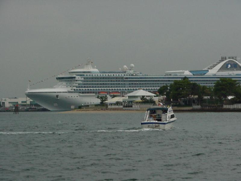 Maybe we should go on this one?
 Tug & tankers dead astern.
 Hasty takes her out the Port Everglades channel.
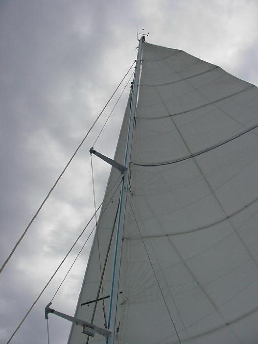 Salty Dog going like a scalded cat!
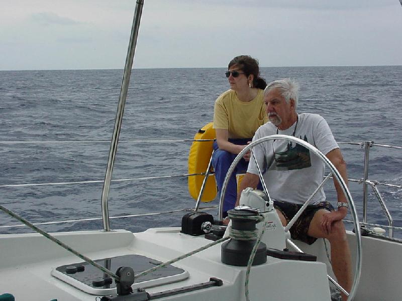 Chris & Bob on the helm.
 Sandy relaxes while the weather is nice.
 Jay & Sandy looking to West Palm Beach on shore.
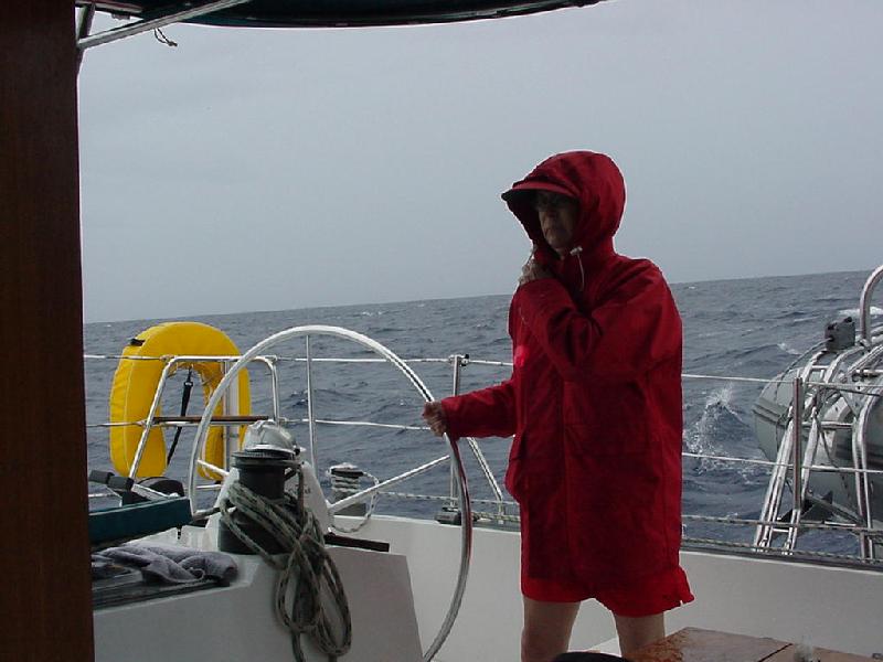 Sandy on watch in the rain.
 Jay & Hasty after the squall passes.
 The St. Lucie buoy viewed from the cabin.
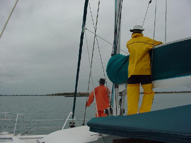 Mel & Bob track the entrance channel marks at St. Lucie.
 Skipper & Mary Kay Van Mell laid out a spread of goodies for the crew.
 Hasty & Mel relax with a libation.
 The Dog cat naps at dawn in St. Lucie.
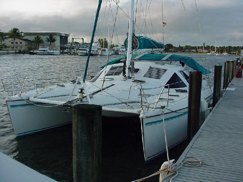 Ready to prowl.
 Indian River Bridge above St. Lucie.
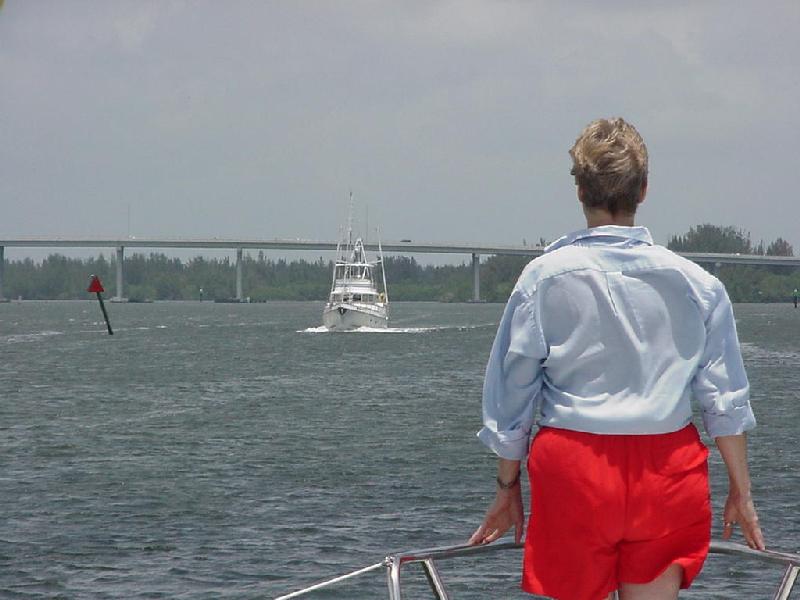 Vessel traffic approaching the Vero Beach fixed bridge.
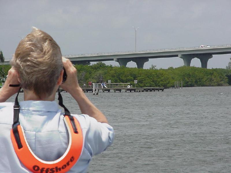 Sandy sights her 89 year old mother on the Lobster Shanty dock.
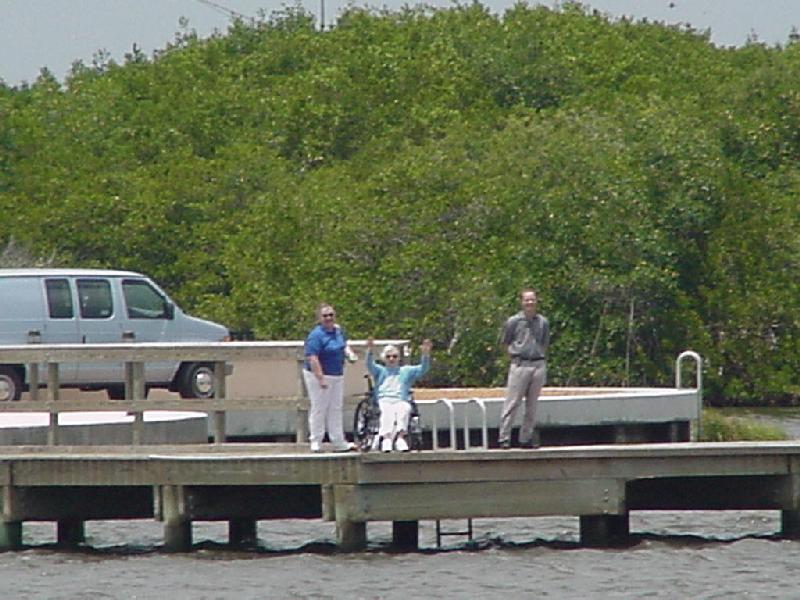 Tina waves and nurse Jackie Mulanax is all smiles.
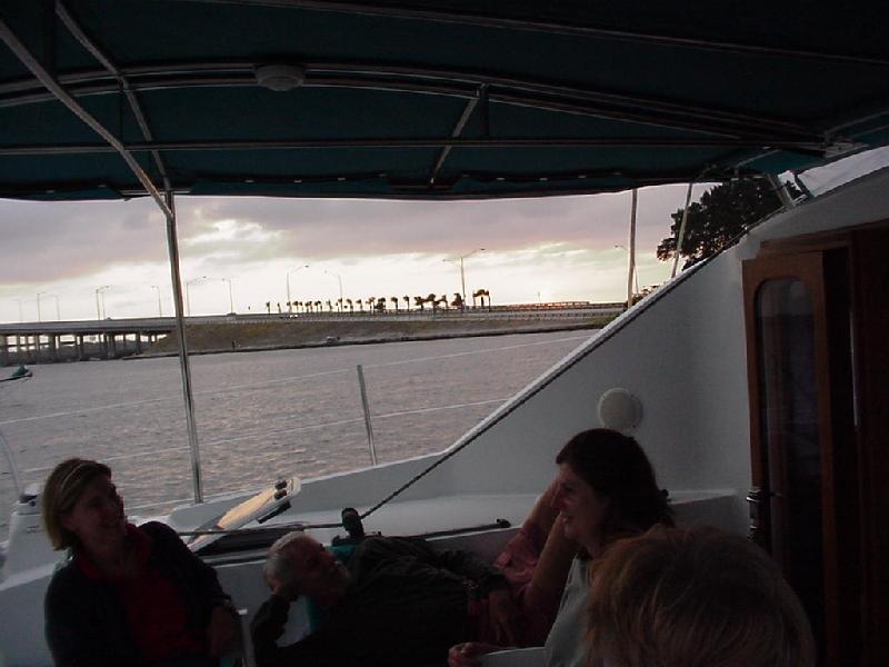 Happy Hour anchored behind Melbourne causeway.
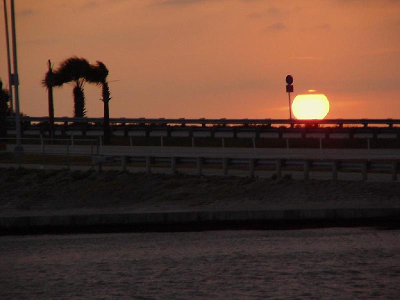 Sunset over causeway - note blowing palms.
 Sandy & Bob are into the songfest.
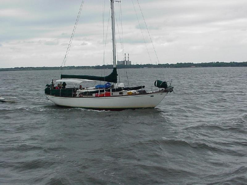 A cruiser headed north near NASA causeway.
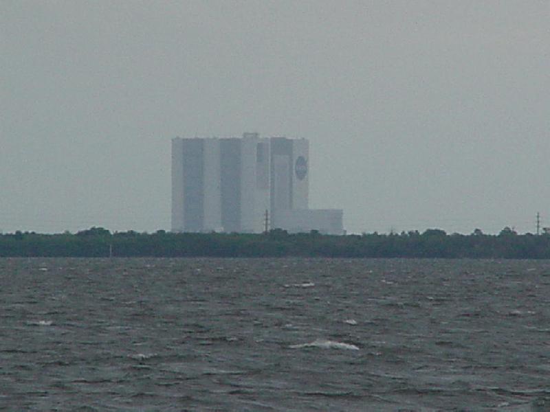 NASA Assembly building about 5 miles away.
 Dredge works near Haulover Canal.
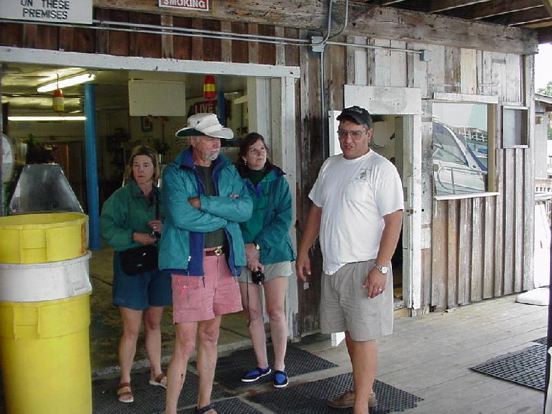 Stopping at the New Smyrna Fish House.
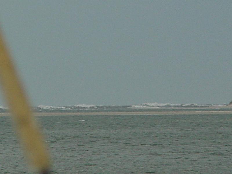 Atlantic breakers smother Ponce de Leon inlet breakwater - why we're not out there!!!!
 Watching for manatees.
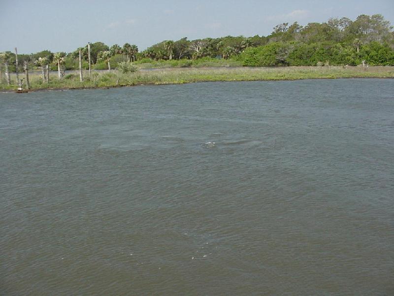 This one is modest.
 Rick makes lunch....
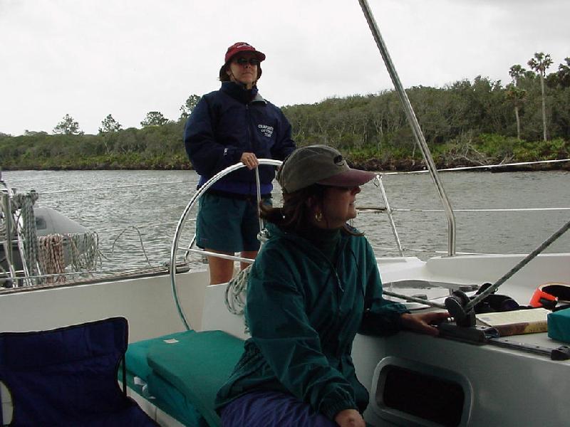 While Hasty steer past the swamps.
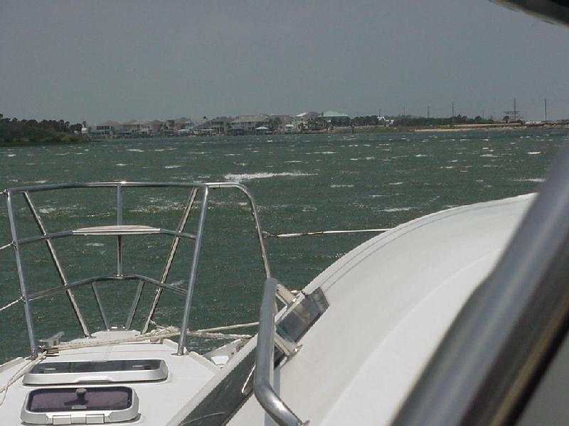 This is what 30 knots on the bow looks like in the ICW.
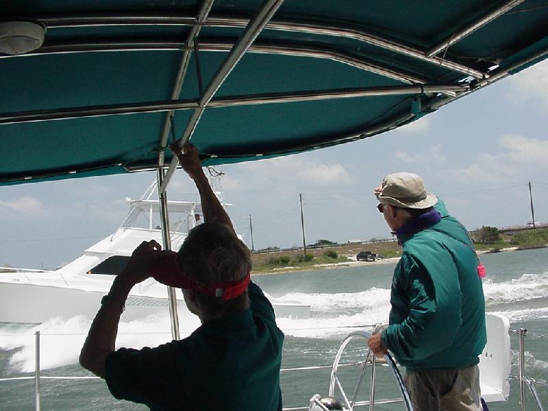 A powerboat blasts past.
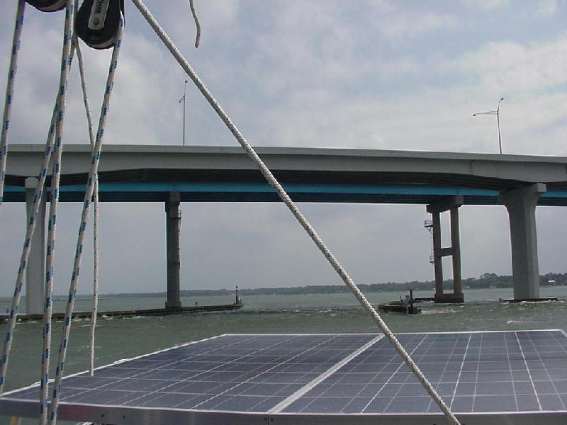 St. Augusting High bridge.
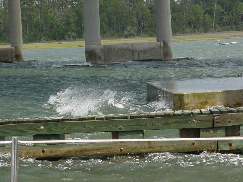 Wind & current against the bridge.
 Antenna brushes bridge girder - common with the high wind-driven water.
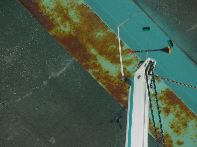 It's a tense time under every bridge.
 St. Augustine light seen from the ICW side..
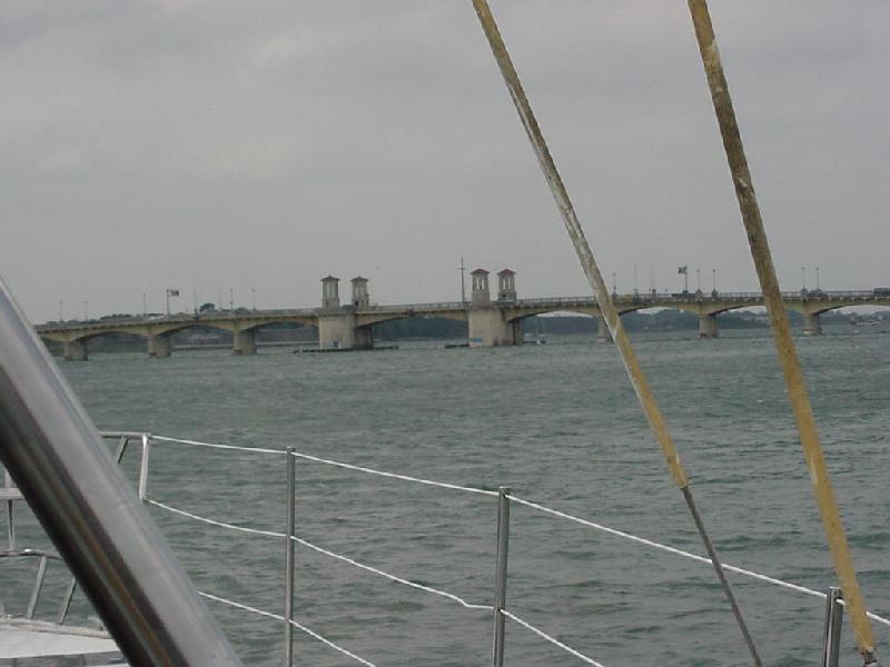 St. Augustine's Bridge of Lions.
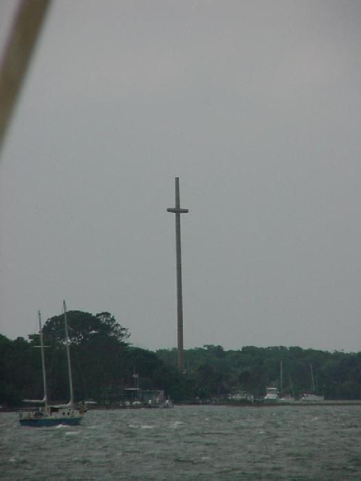 The inner end of the St. Augustine channel - you explain it!
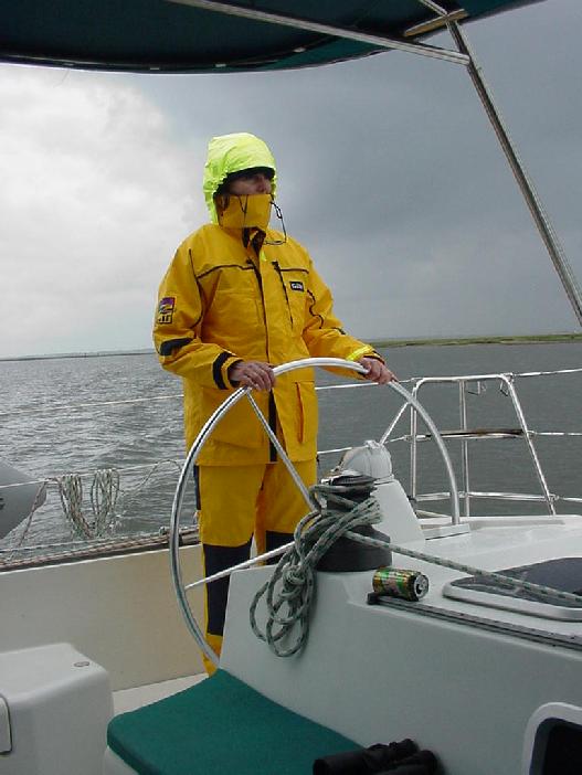 Chris enjoys a misty Thursday morning.
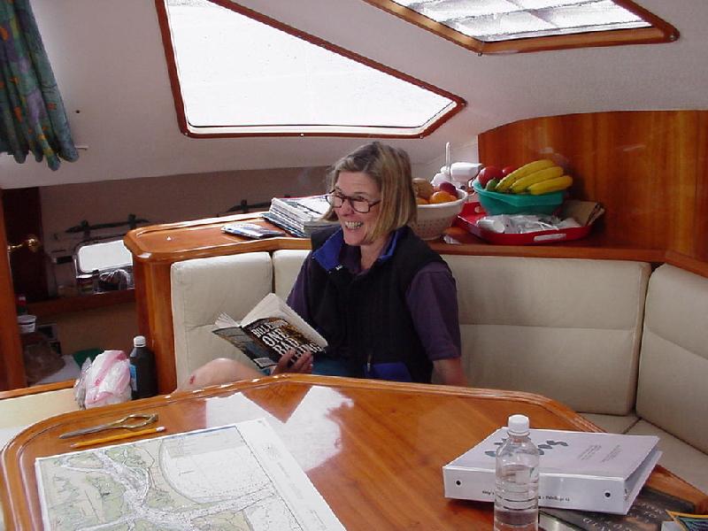 Hasty's serious cruise reading.
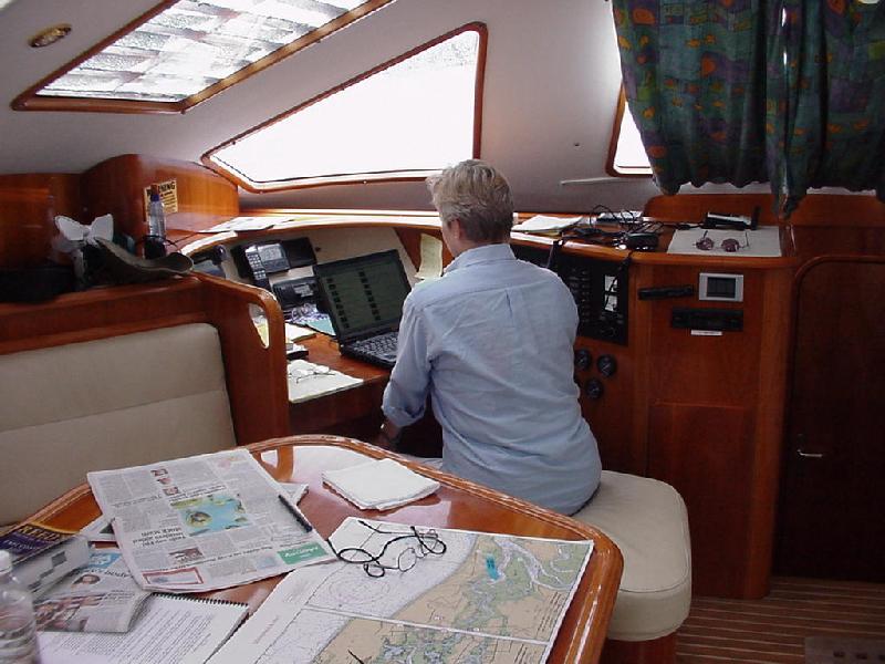 Sandy reviews the web page.
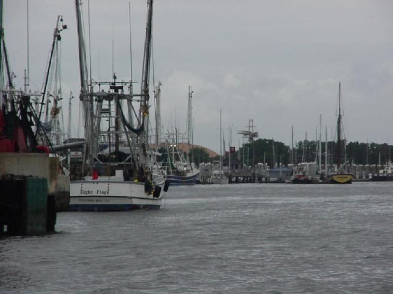 Even Frenandina's fishing fleet stayed in.
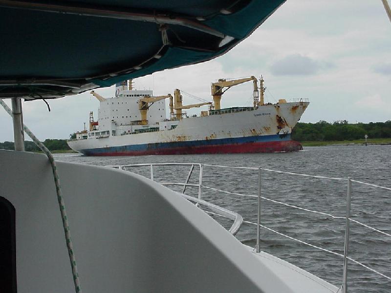 Channel hog!
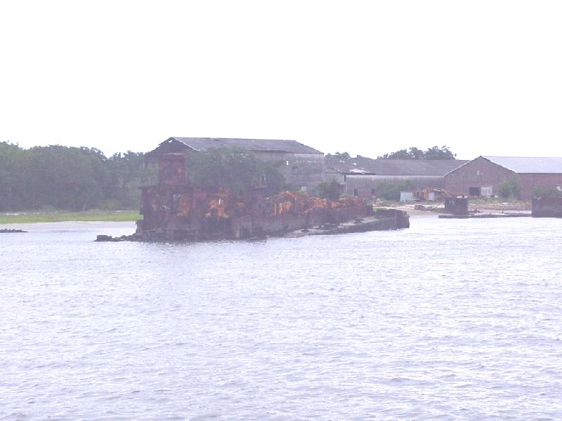 The last barge load!!!!!!
 The tug that pulled it.
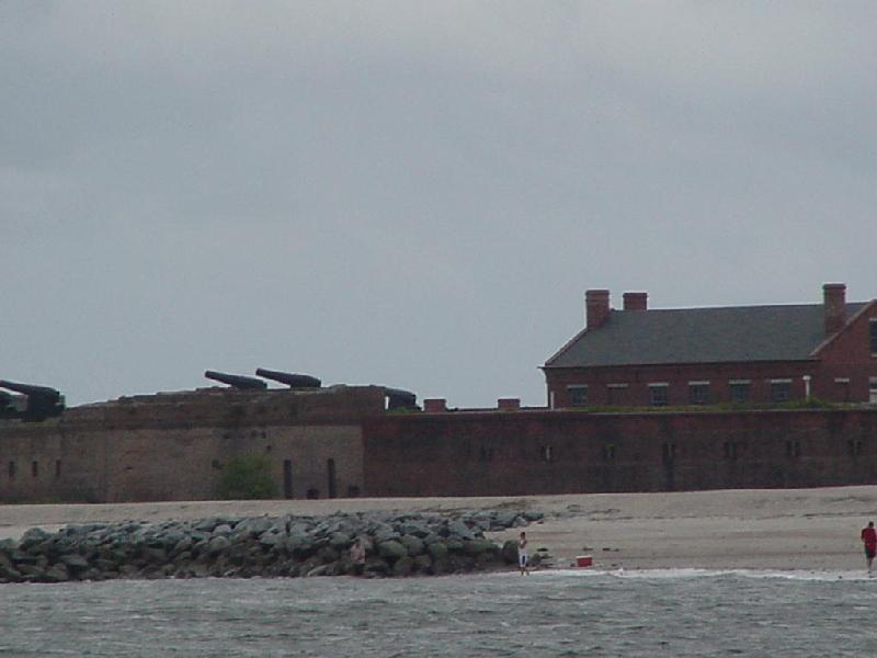 Ft. Clinch keeps those northern Georgia folks out of Florida!
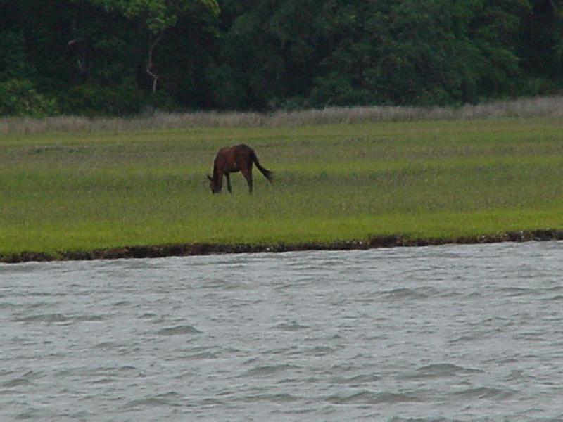 A wild horse grazes on Cumberland Island.
 The abandoned lighthouse at St. Andrews Sound.
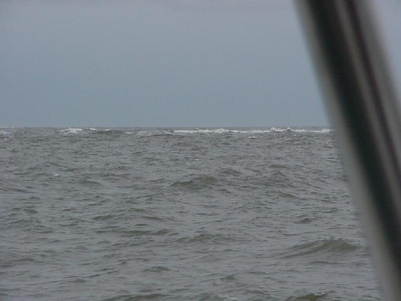 St. Andrews Sound is still kicking up as we cross to Jekyll Island.
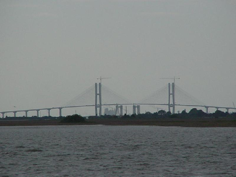 The New Brunswick bridge under construction.
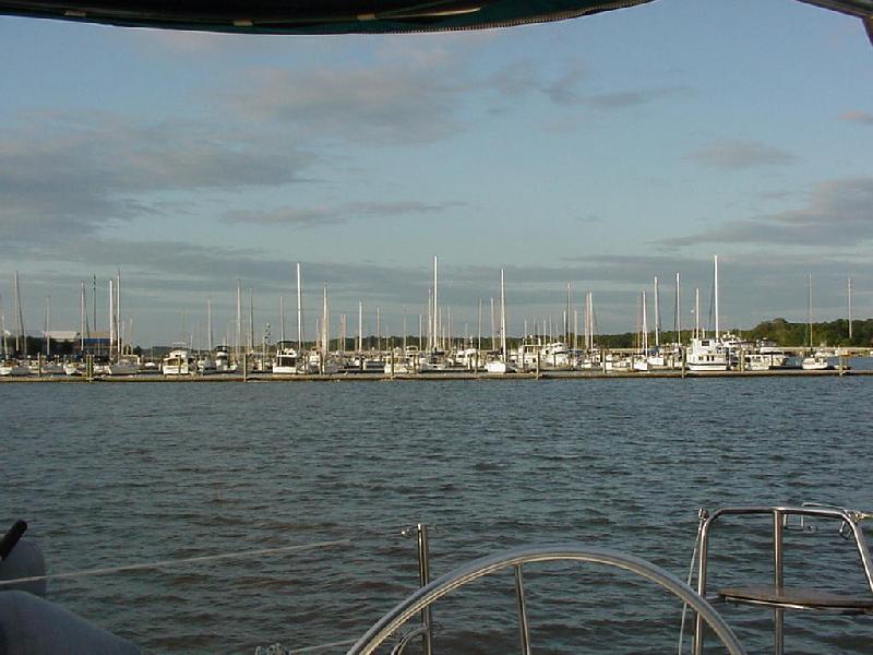 We're anchored off Lanier Island Marnia on Thursday night.
 Charleston Light at sunrise departure for Beaufort.
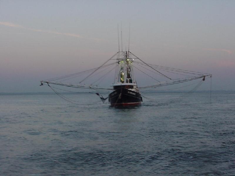 Fishing the morning Charleston tide.
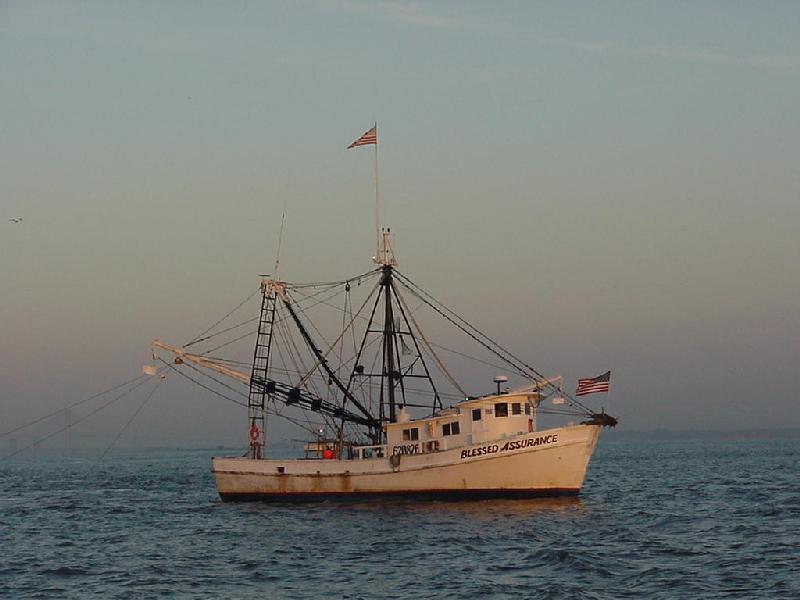 Pretty & Patriotic fishing abeam of Ft. Sumter.
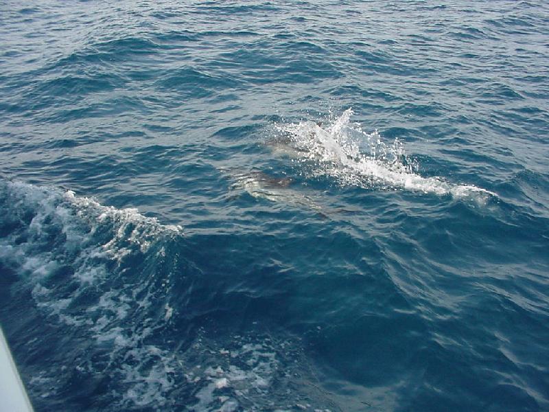 35 miles offshore aproaching Cape Fear dolphins play cat & Mouse with the Dog.
 Bob created Wilson to watch over us.
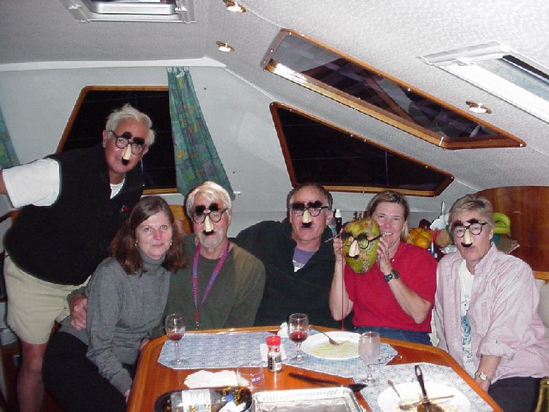 Wilson assembles his crew.
 We sang in the moonlight at Frying Pan Shoals.
 Pamlico Sound Scouts!
 Anchored at Slade Cr., waiting for chicken to grill.
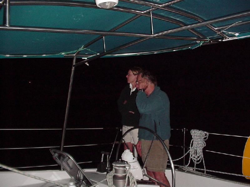 J & H waiting for chicken.
 Moonrise at Slade Creek, 5/26.
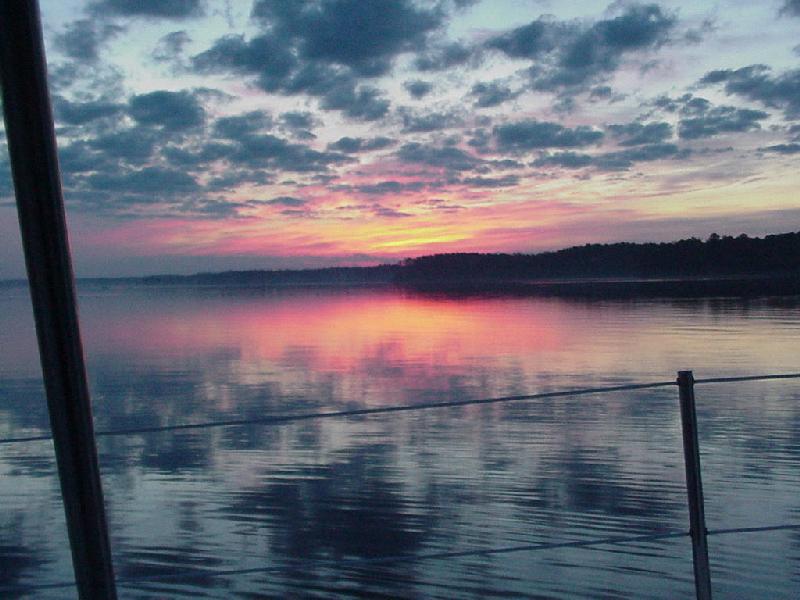 Sunrise 5/27.
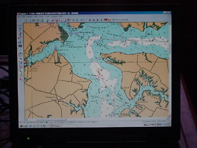 FUGAWI tracks departure from Slade Creek.
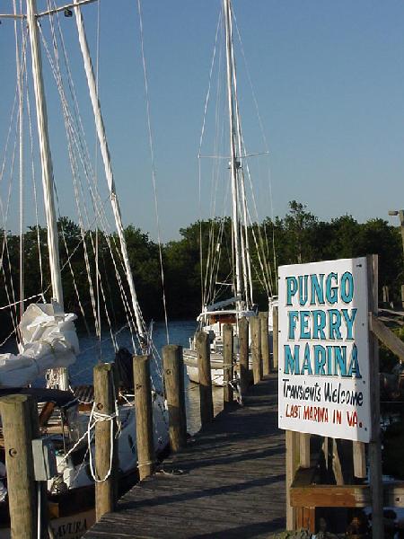 Pungo Ferry Marina, Monday 5/27
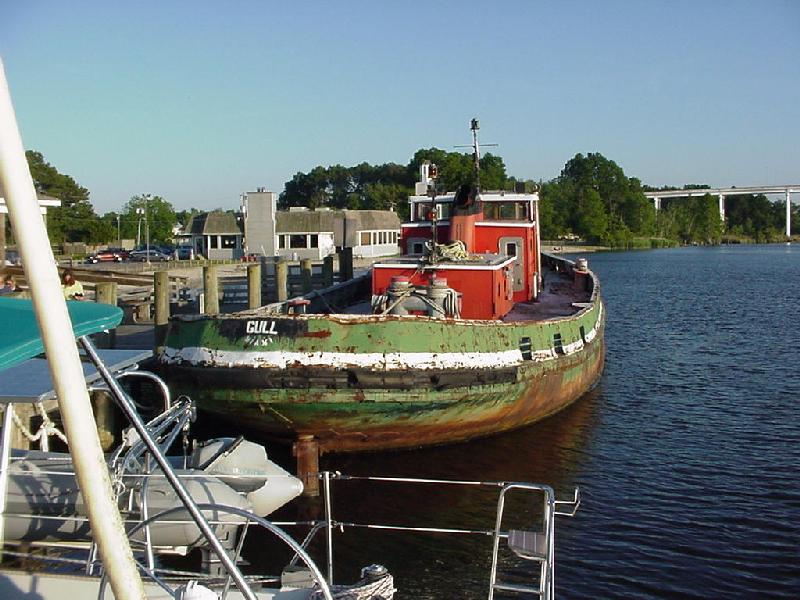 Want a tug? Captain George's 4 -star restaurant beyond.
 Dockside Shopping.
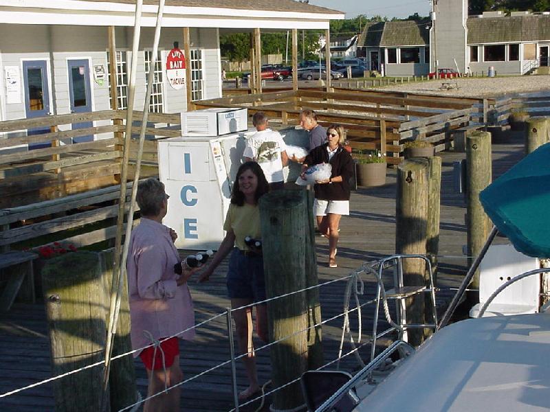 The results!
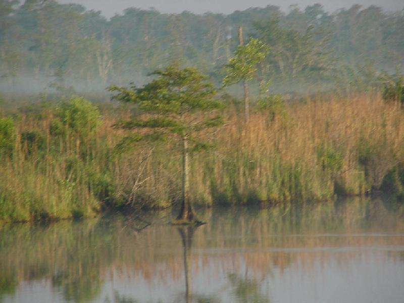 Morning in the marsh.
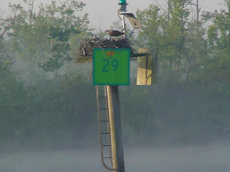 A wary Ospry guards her nest.
 Someplace in time.
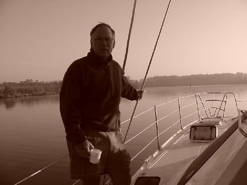 Jay tries coffee to clear the mists.
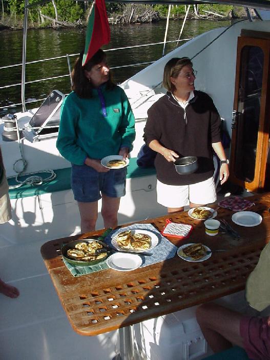 Hasty & Chris serve up great French Toast.
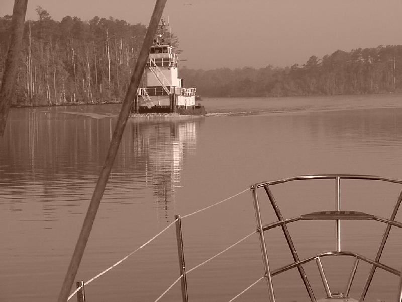 Southbound pusher wanted to stop for some.
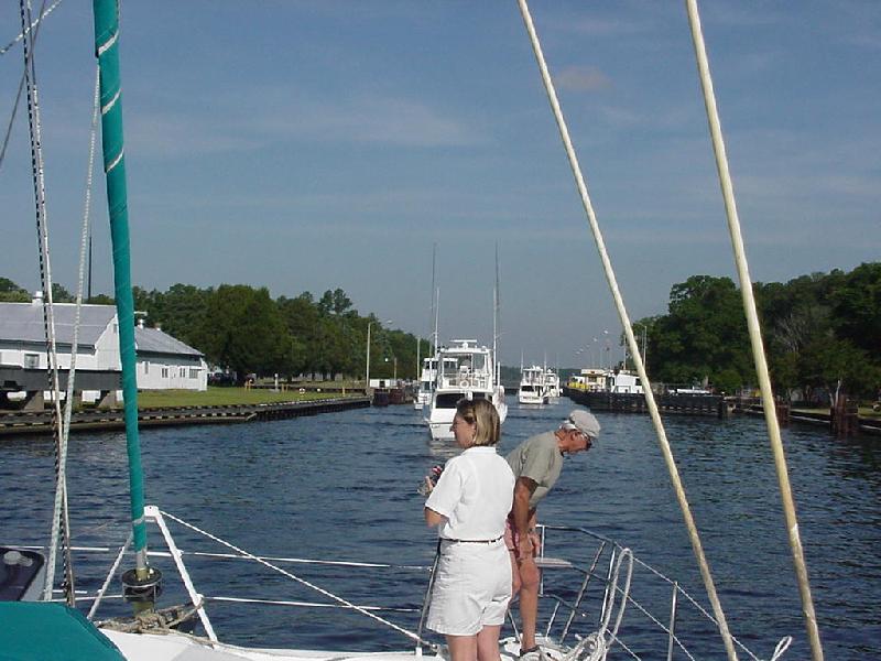 Entering the Great Bridge locks.
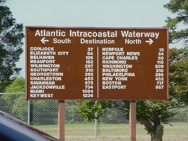 Lets you know where you are!
 Viet Nam river boats didn't clear the bank!
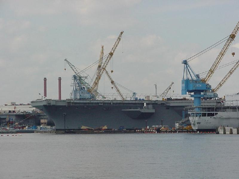 A little bigger sailor boat.
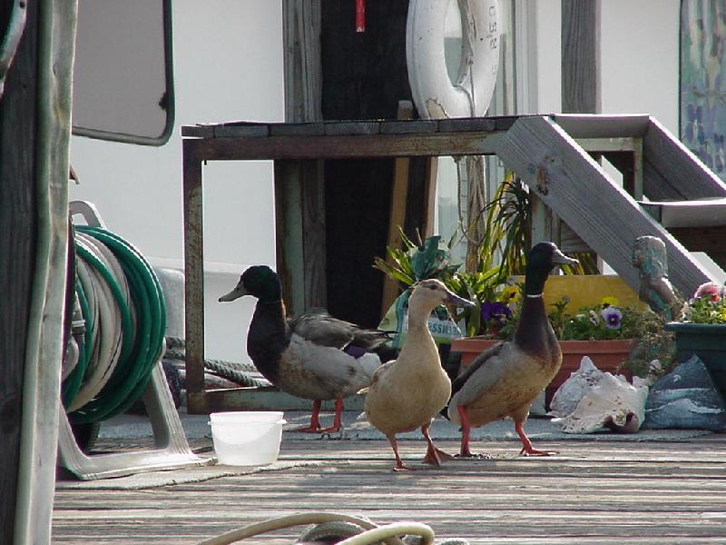 Little Creek Mallards stalk the dock for handouts.
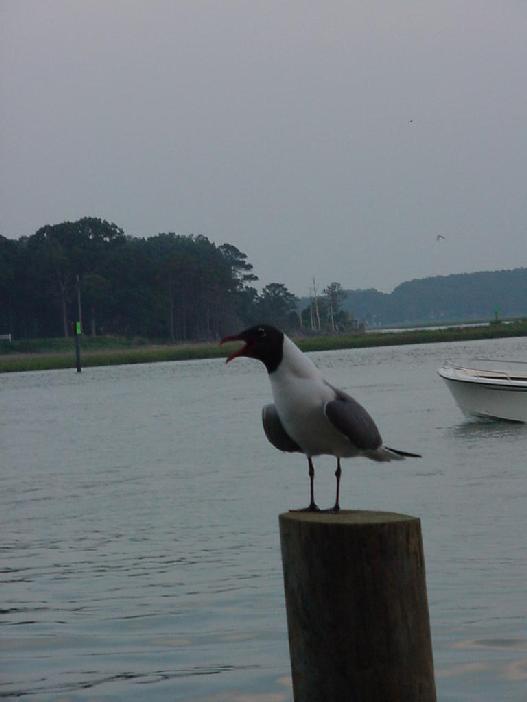 Bubba's tern squawks for Bob's French-fry handout.
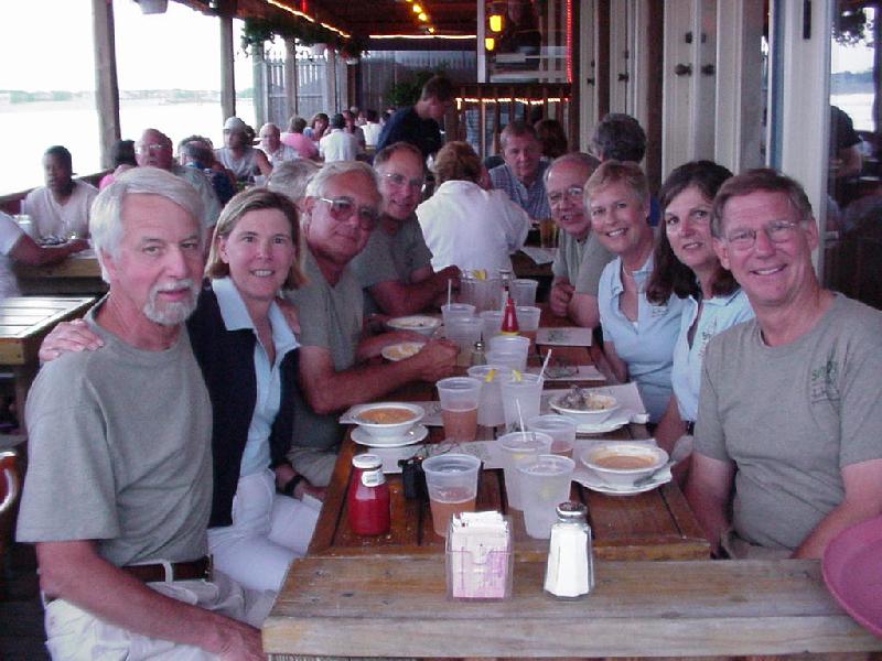 Bubbas' Restaurant crew party at Little Creek.
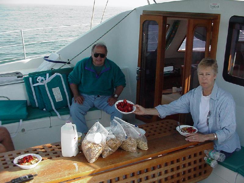 George's hand-picked strawberries add an elegant note to our Cape May breakfast.
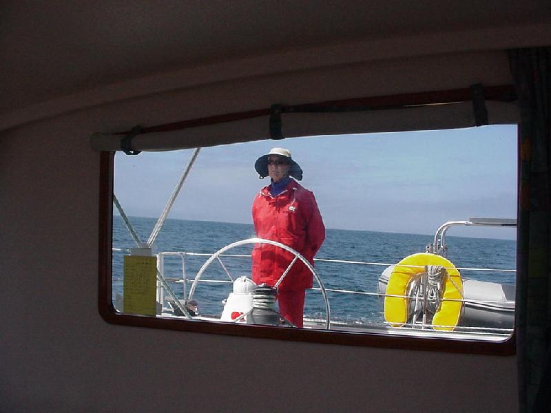 Sandy stands watch as fog clears on Block Island Sound. Watch schedule posted on the glass.
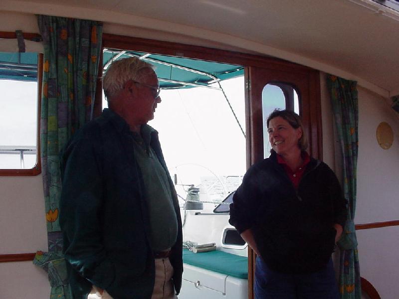 Mel & Hasty celebrate the course change past Tarpaulin Cove.
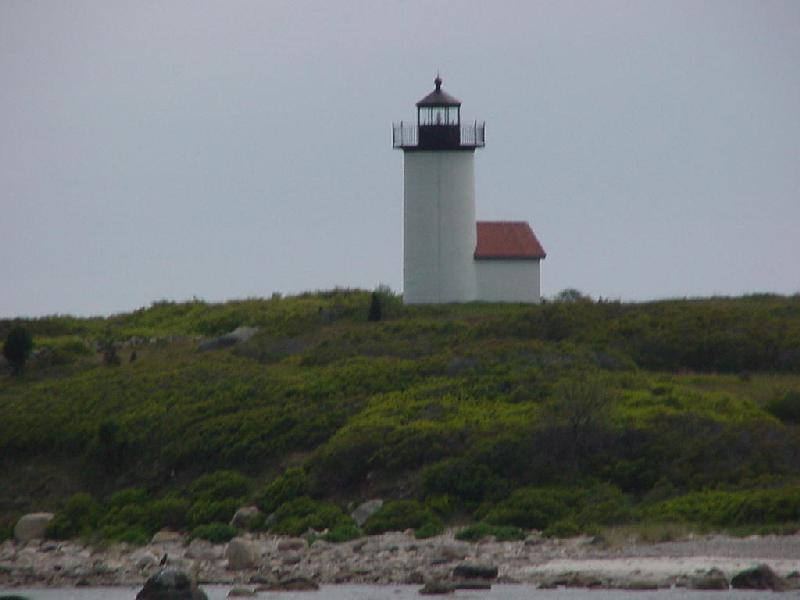 Lighthouse at Tarpaulin Cove.
 1800's house at Tarpaulin.
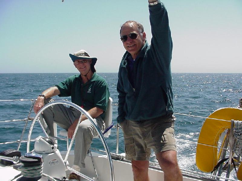 Jay keeps an eye on Rick.
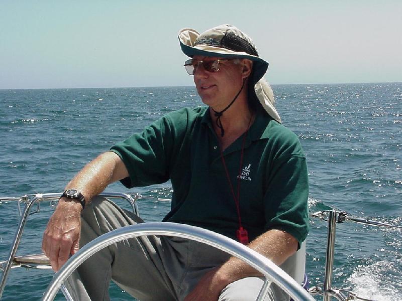 Do you think Jar Jar Binks can find the way????
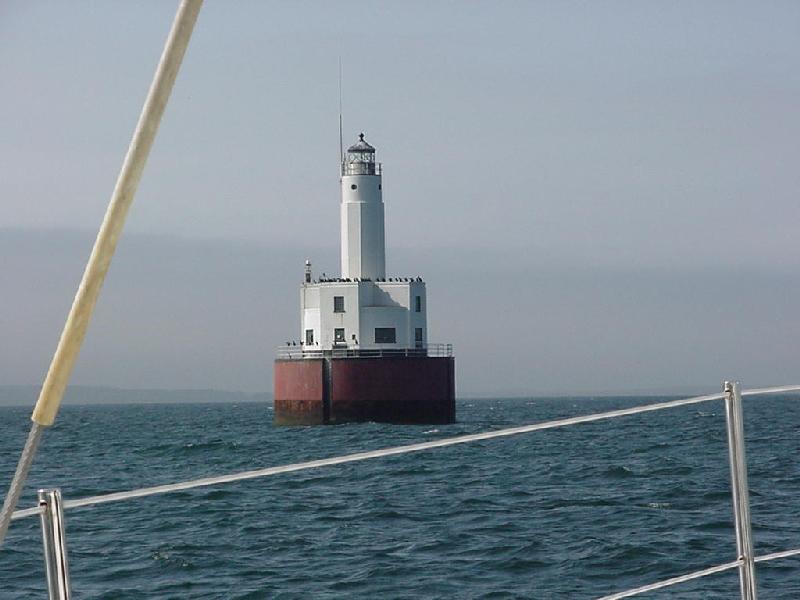 Cleveland Ledge Light.
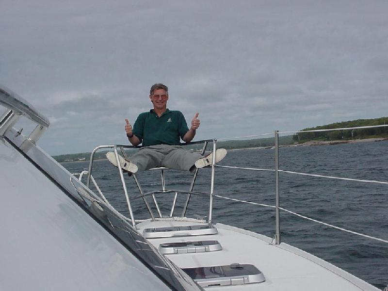 Rick Celebrates pulling into Scraggy Neck.
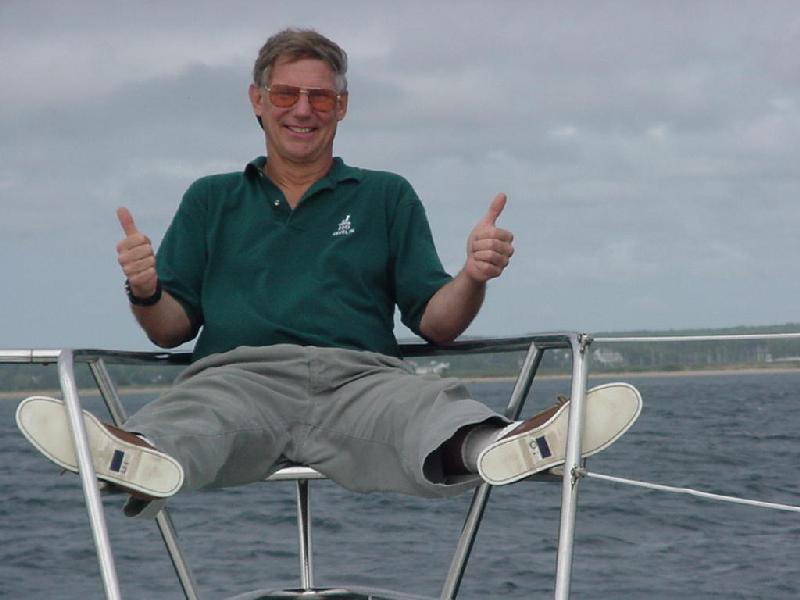 Enough cooking, picture taking, log writing & navigating. It's time to party.
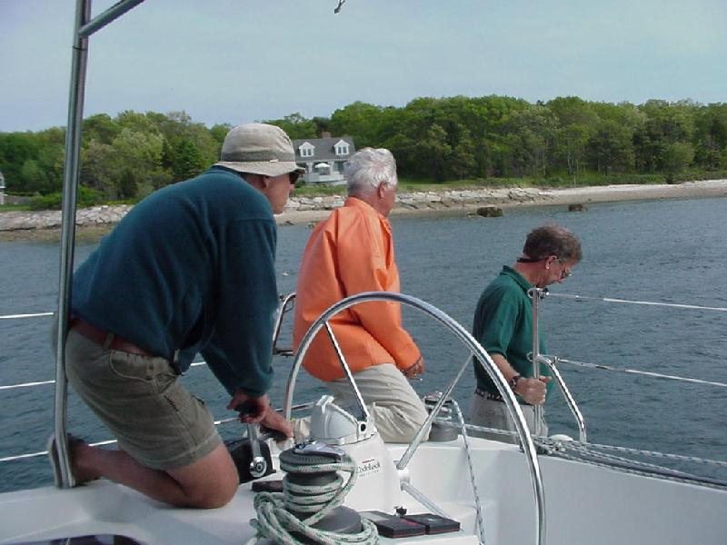 Picking up the reluctant mooring.
 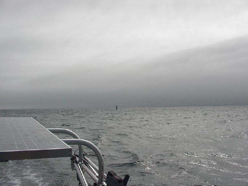 Dirty weather followed us into port.
 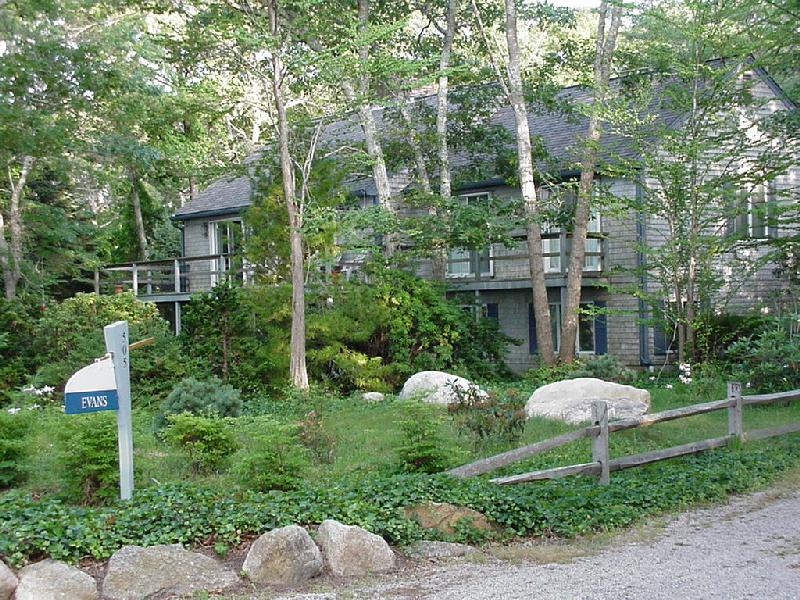 Jay & Hasty's wonderful house.
| Go To Top |